Day 3: U.S. and Canada West Coast Drive
You can jump to a specific day:
Yosemite National Park
CLICK TO JUMP TO:
Drive from Oakhurst, CA to Yosemite South Entrance • Pioneer Yosemite History Center • Drive from Pioneer Yosemite History Center to Washburn Point • Washburn Point • Glacier Point • Taft Point Trail • Tunnel View • Bridalveil Fall Trail • Drive from Bridalveil Fall Trail with Scenic Pullovers to Parking for hike to Mirror Lake • Mirror Lake Trail • El Capitan Meadow • Valley View
We grabbed breakfast at our hotel in Oakhurst, CA and picked up some food at a deli to bring along for lunch. The drive to our first stop in Yosemite was only 40 minutes, so we had all day to enjoy the incredible beauty of Yosemite National Park.
Click here for a link that has maps for Yosemite National Park that you can download to have ready for your trip if you would like.
You can download a National Park Service app that has lots of helpful information for over 420 parks in the U.S., including Yosemite National Park.
DRIVE FROM OAKHURST, CA TO YOSEMITE SOUTH ENTRANCE
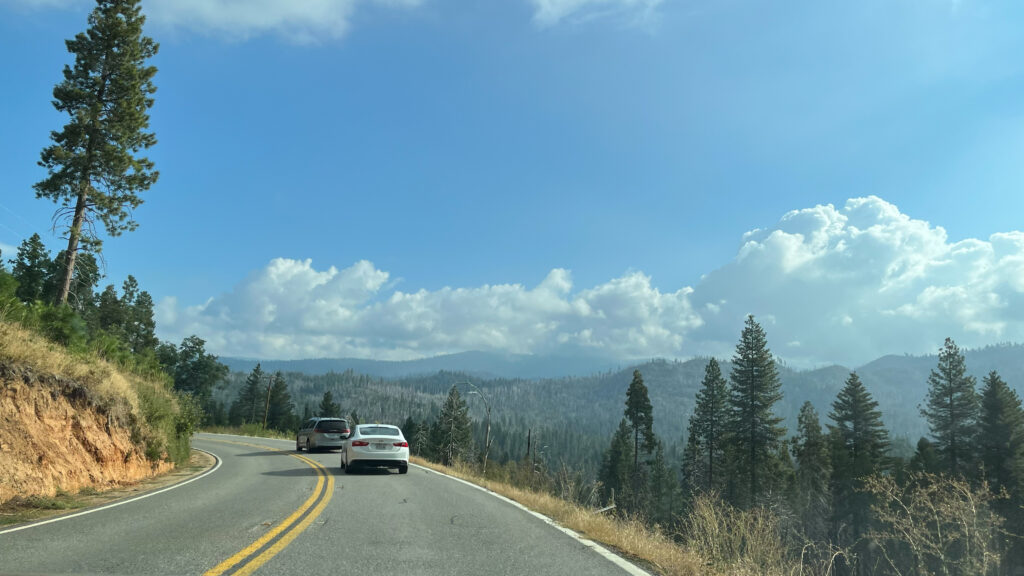
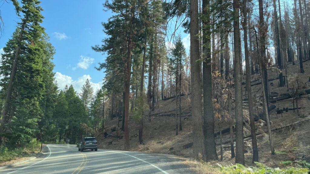
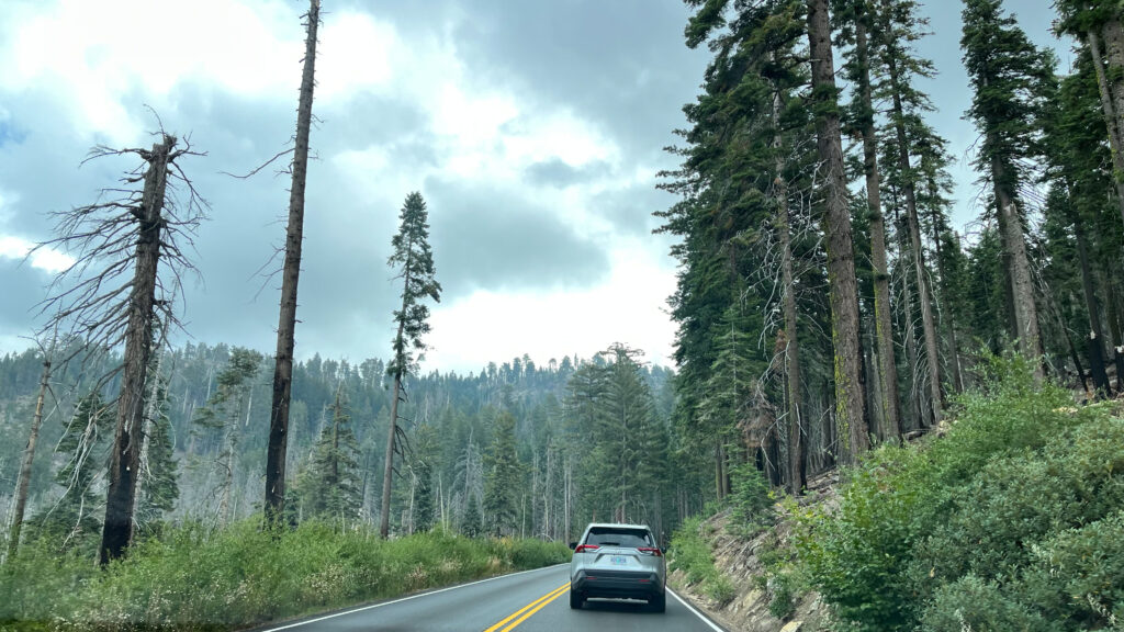
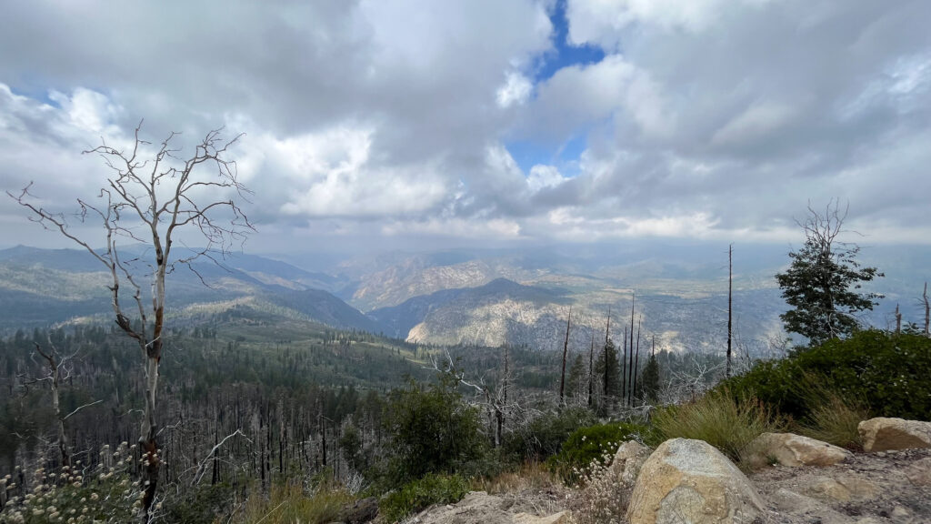
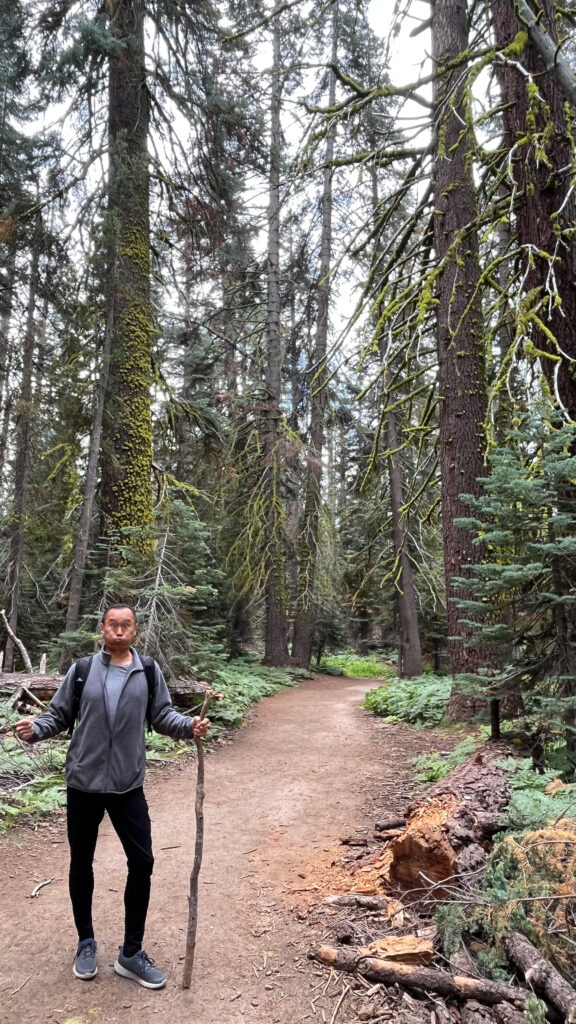
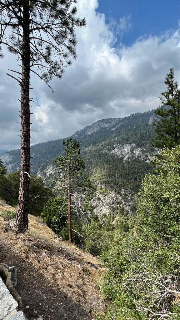
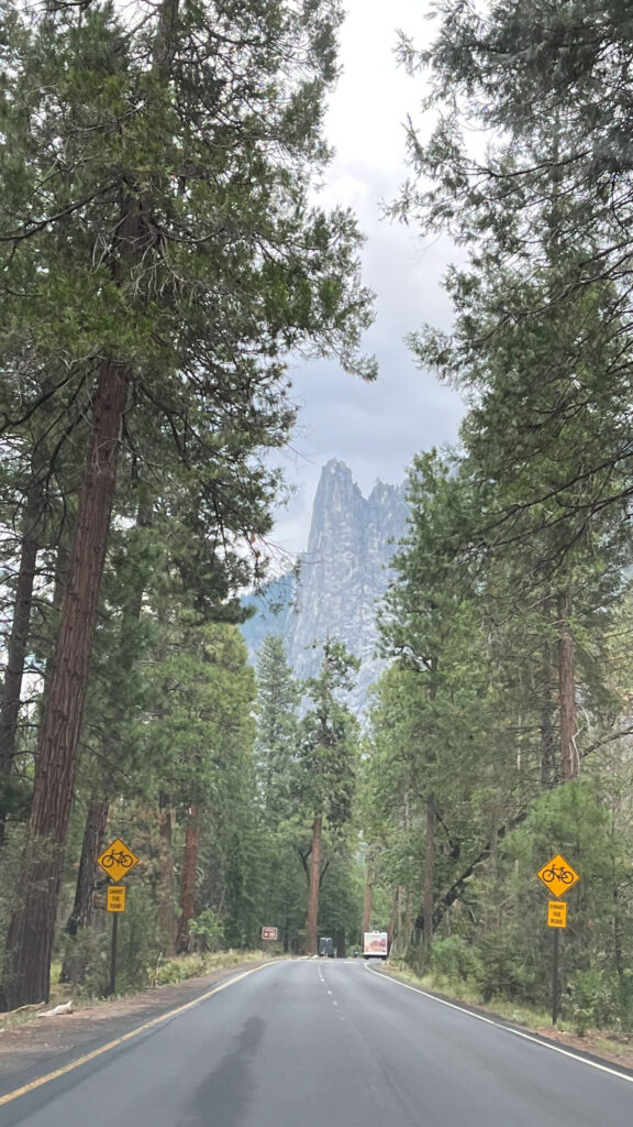
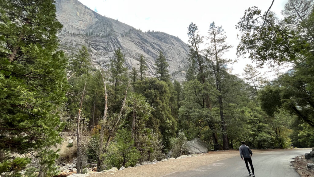
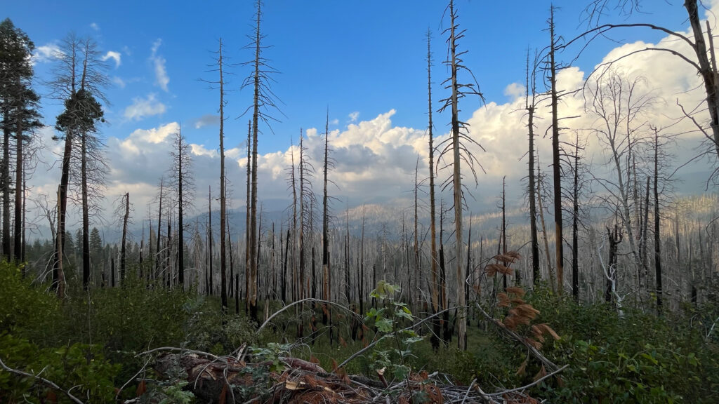
The drive from Oakhurst, CA to Yosemite History Center was scenic. There were sections of burnt trees along the way. The pictures directly below show a glimpse, in order, of our drive to Yosemite.

From Highway 41 we took the South Entrance into Yosemite. Highway 41 becomes Wawona Road inside Yosemite National Park.
The entrance fee was $35 per private vehicle, which includes everyone in the vehicle. You can scroll through the story for the previous day for this trip (Sequoia National Park) to find a section where I’ve provided a lot of information and links about the America the Beautiful Pass.
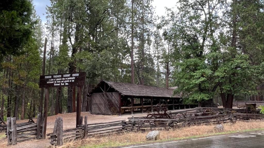
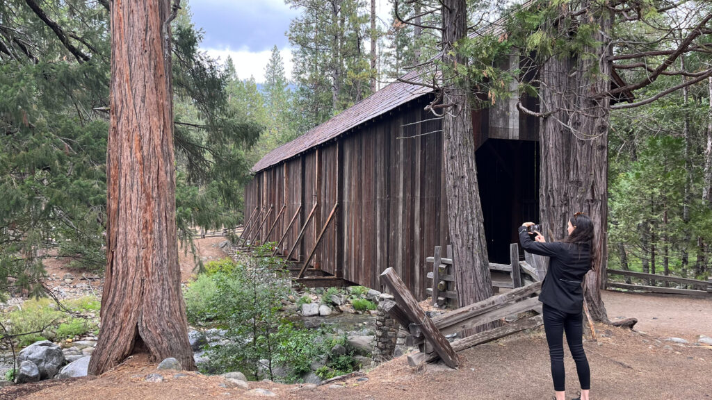
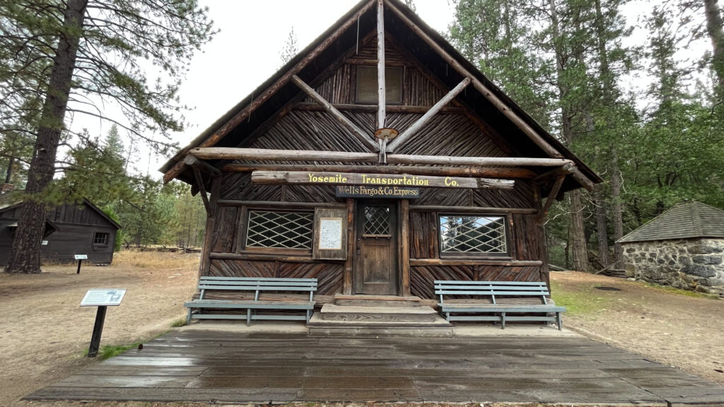
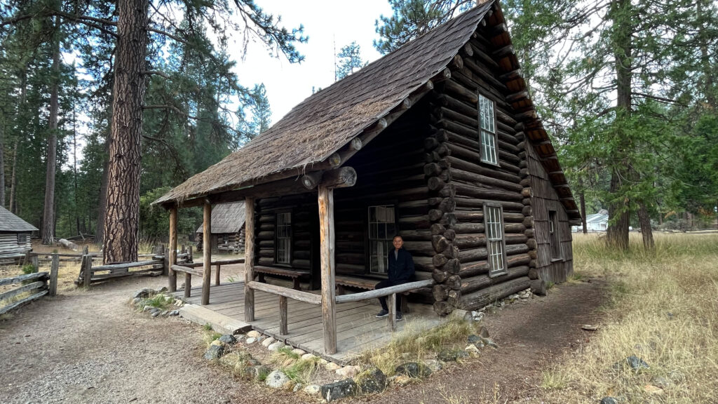
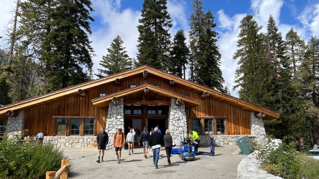
PIONEER YOSEMITE HISTORY CENTER
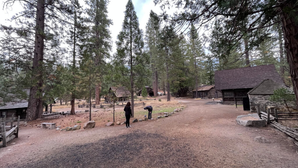
Our first stop was Yosemite History Center, which is also known as Pioneer Yosemite History Center. Click here for another link on Pioneer Yosemite History Center. To get to Yosemite History Center – if you’re driving northwest on Wawona Rd after entering the park from the Highway 41 South Entrance to Yosemite National Park (Highway 41 becomes Wawona Road inside Yosemite National Park), then make a right turn onto Forest Drive, then turn right into the parking lot on the right side of the road (it’s about a ten minute drive from the highway 41 south entrance to the parking lot.) From the parking lot, cross Forest Drive by foot and you’ll then be at Yosemite History Center.
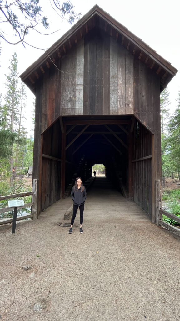
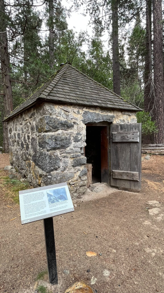
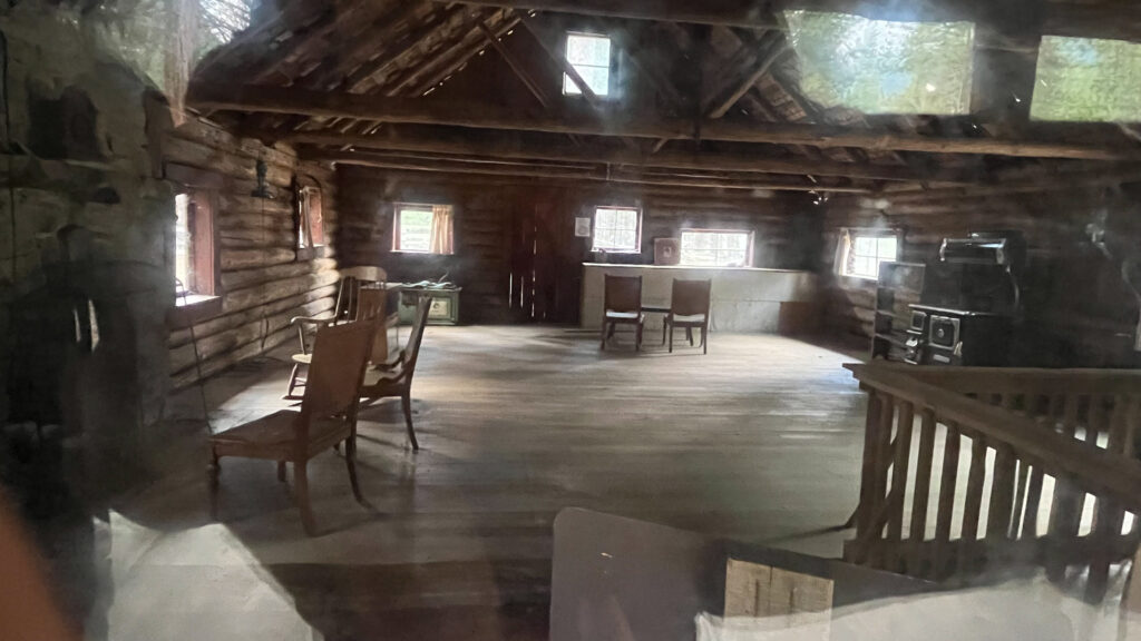
You have to keep an eye out for Pioneer Yosemite History Center because you could easily pass right by it and not even realize it. I’m so glad we didn’t miss it because we both thought it was very interesting to visit. I think maybe a lot of people miss it because there were only two other people walking around Pioneer Yosemite History Center when we were there. It’s included with the Yosemite National Park admission.
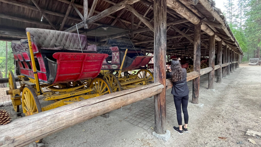
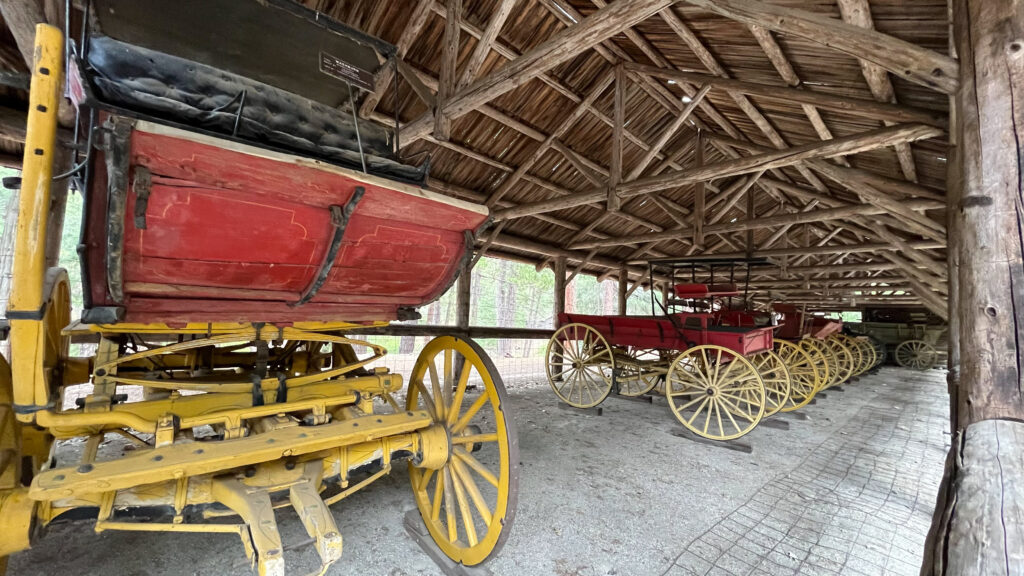
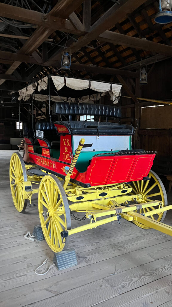
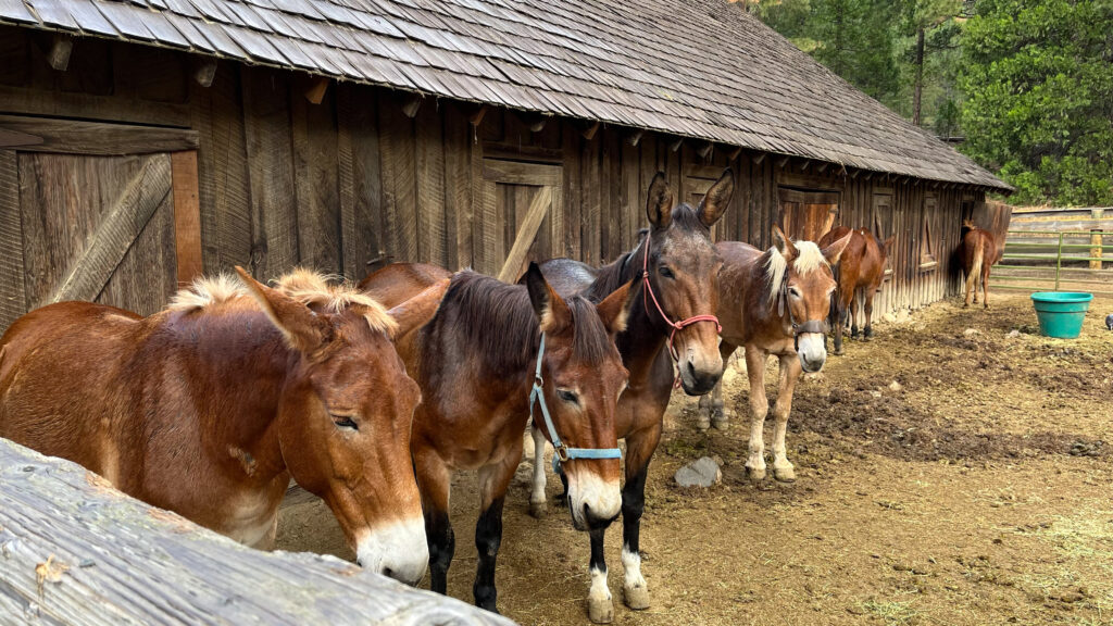
They offer stagecoach rides for a fee, but they weren’t running the stagecoach when we were there. Also we couldn’t tour the buildings for safety reasons when we were there, but there are times when they open them for people to tour the insides of the buildings. We peeped through the windows, which was fun. One of the buildings belonged to a man and his wife who were both painters who lived for periods of times in that home so that they could paint the beauty of Yosemite.

DRIVE FROM PIONEER YOSEMITE HISTORY CENTER TO WASHBURN POINT
(Something that I considered doing, but then opted not to because I knew we would be doing Sequoia National Park the day before visiting Yosemite, was to visit Mariposa Grove of Giant Sequoias. This is located in the southern portion of Yosemite. You can click on this link for more information about it.)
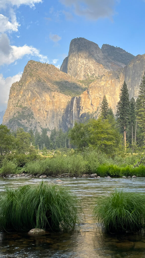
Our next stop after visiting the Pioneer History Center was Washburn Point. Washburn Point is “Located along the Glacier Point Road, near Glacier Point. From Yosemite Valley or Wawona, take the Wawona Road (Highway 41), then turn east onto Glacier Point Road.”
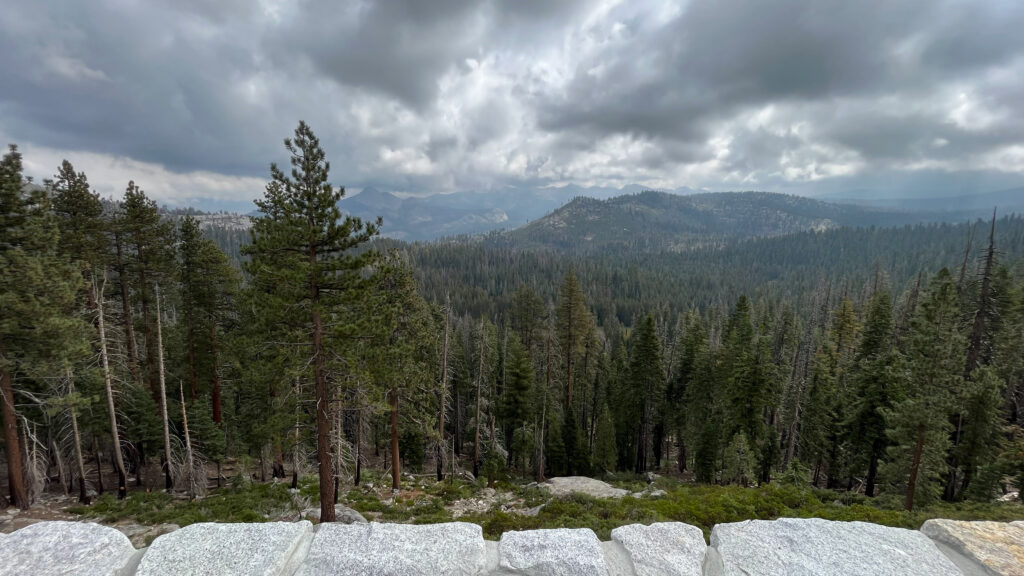
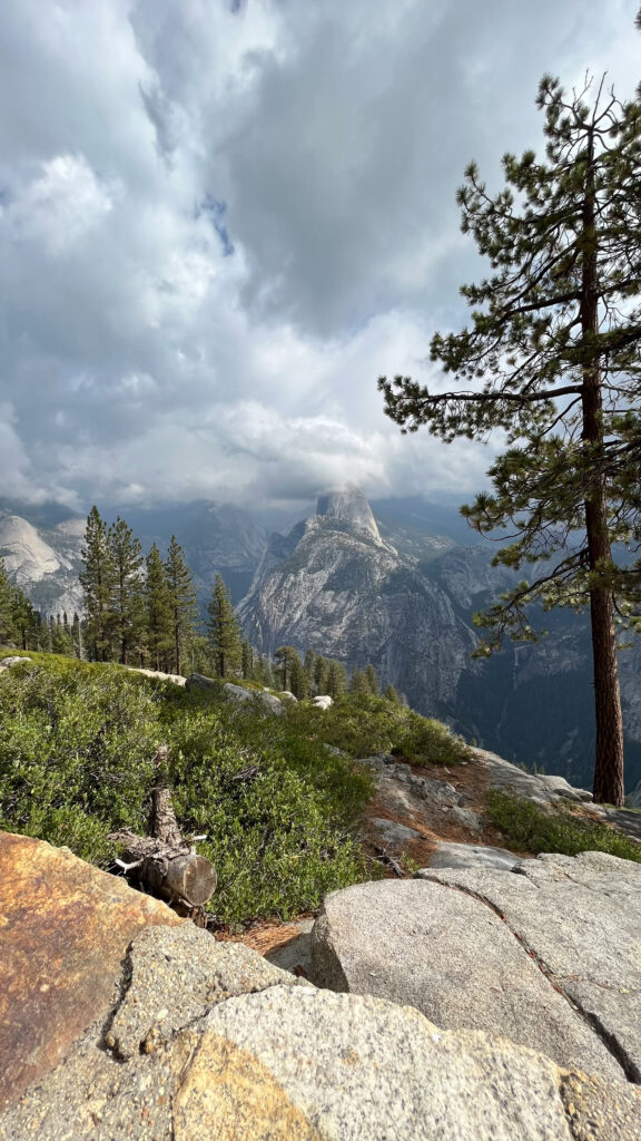
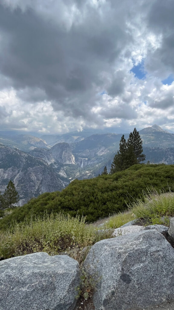
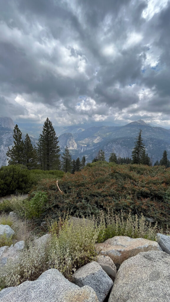
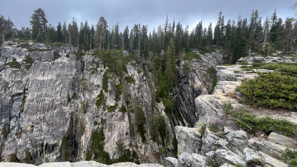
WASHBURN POINT
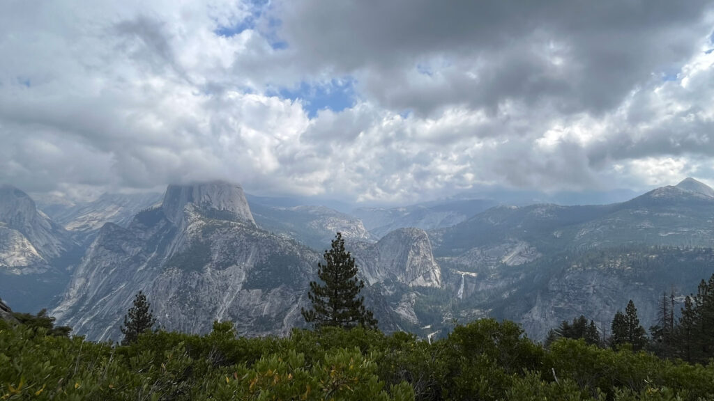
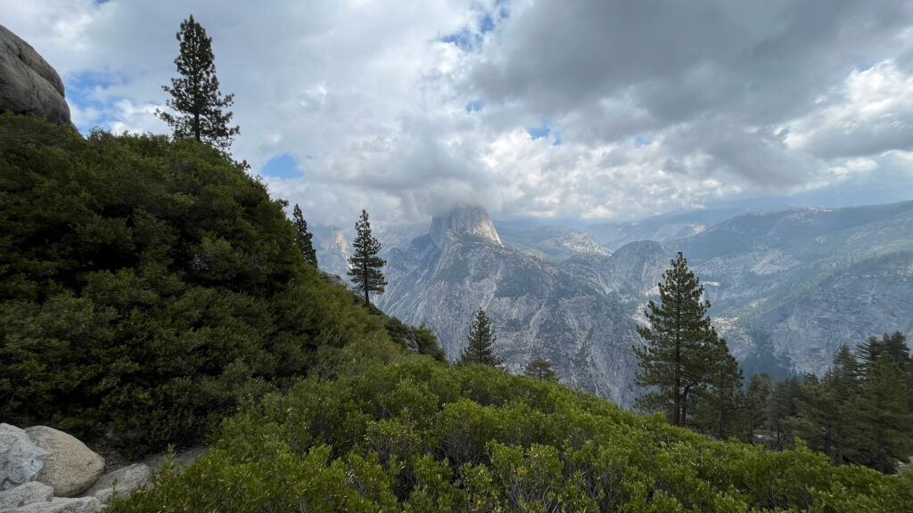
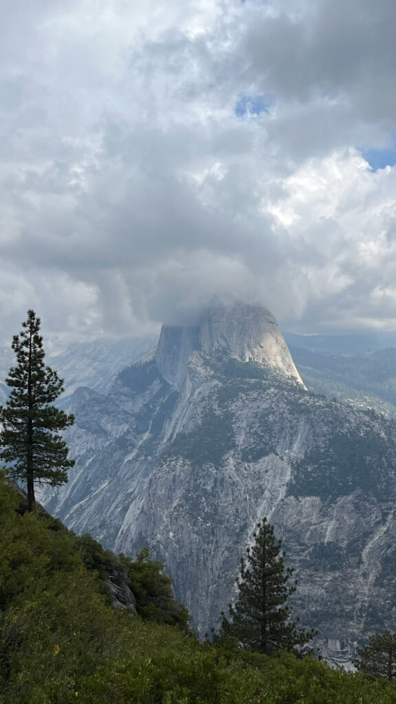
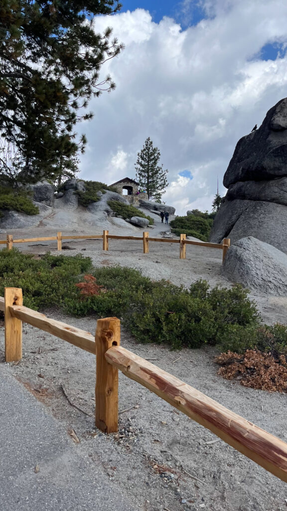
There is a parking lot at Washburn Point with a very short walk to get to the overlook. This overlook is on the other side of the park from where Yosemite Valley is. As you can see in the photo below, there is a short set of steps that lead you to the overlook. There are a few areas to this overlook so you can get a wide view of Yosemite and the eastern crest of the Sierra Nevada. The photos don’t even come close to capturing all of the beauty of Yosemite.
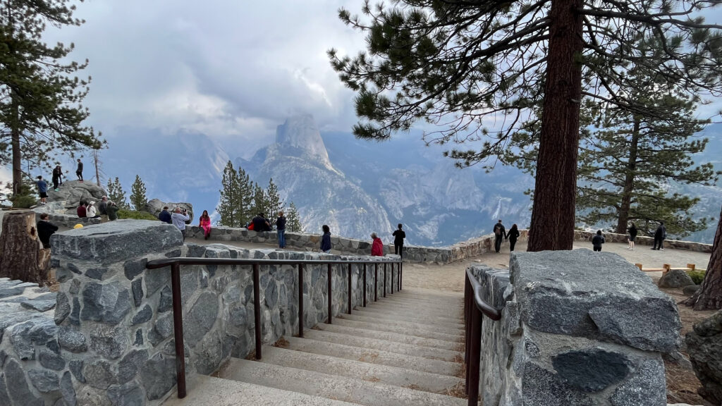
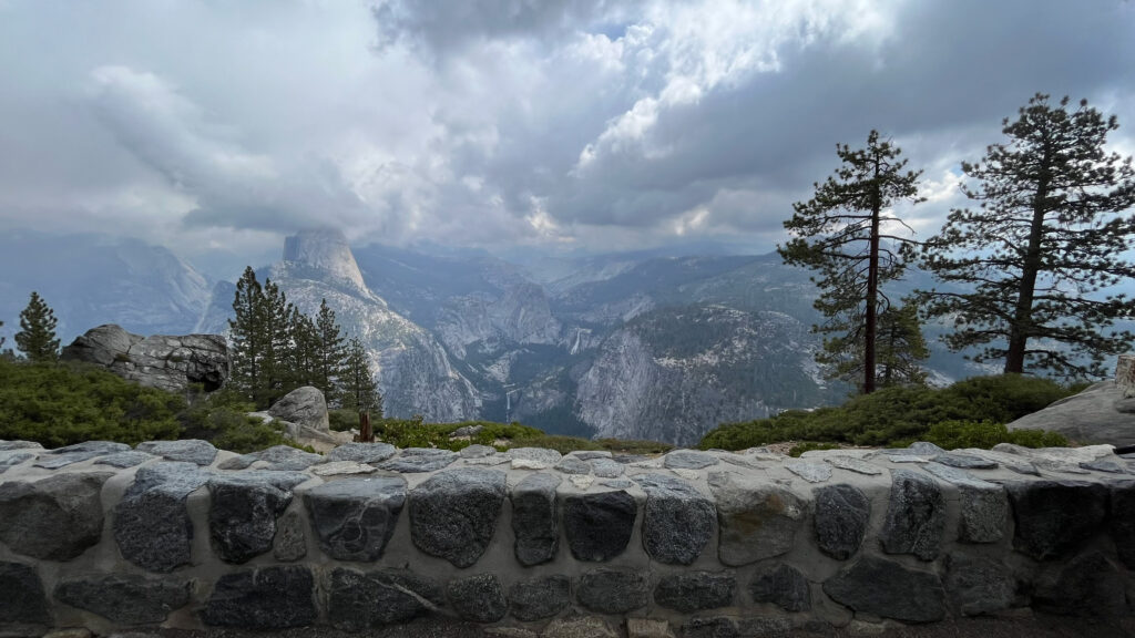
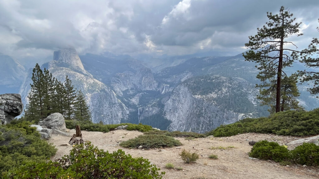
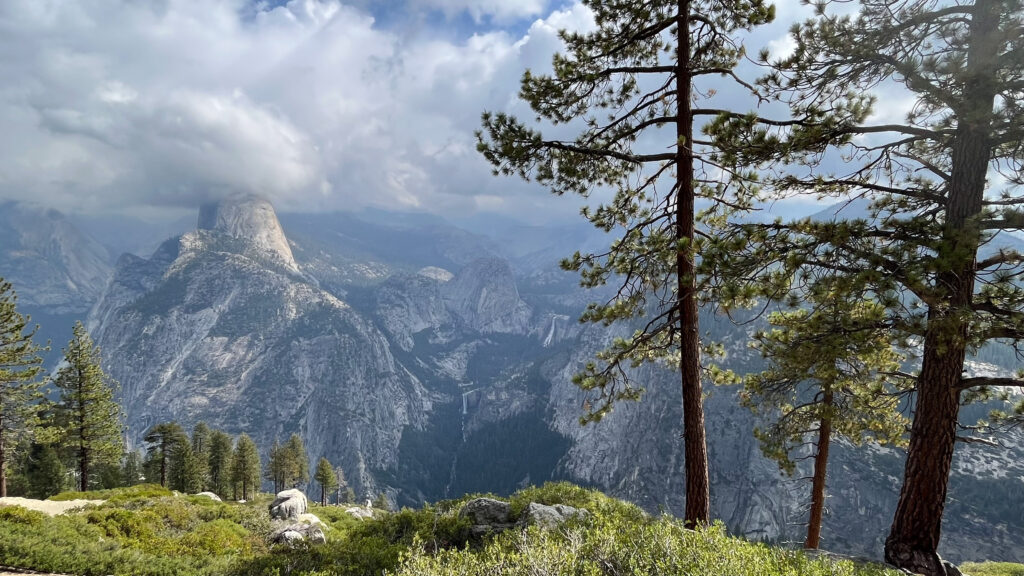
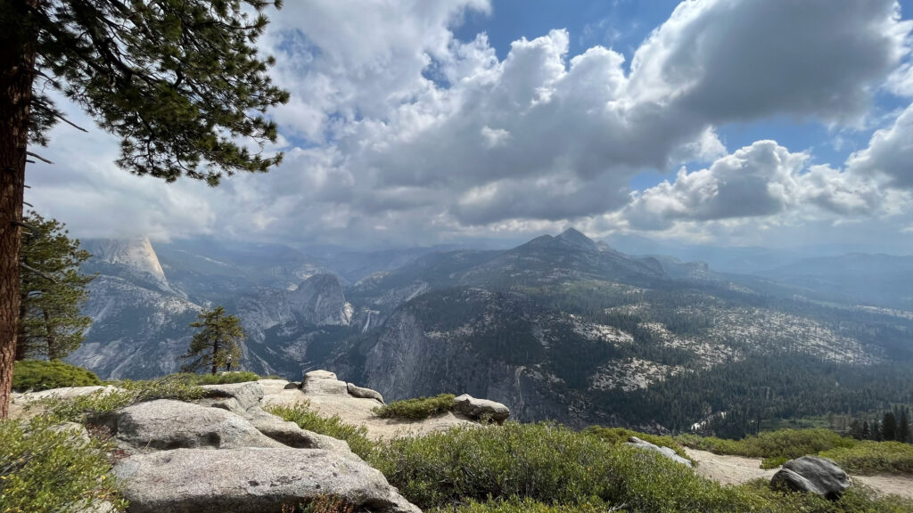
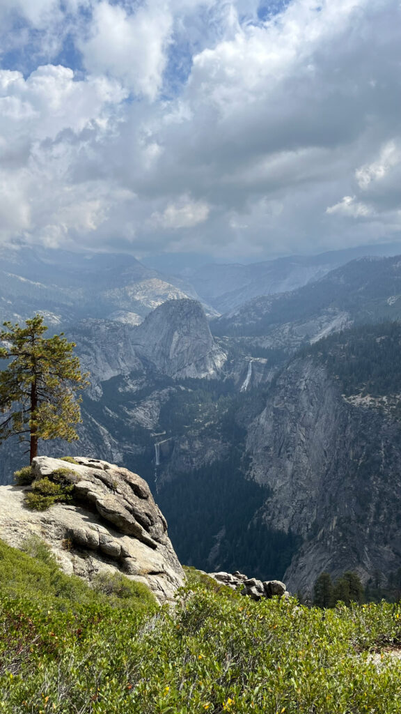
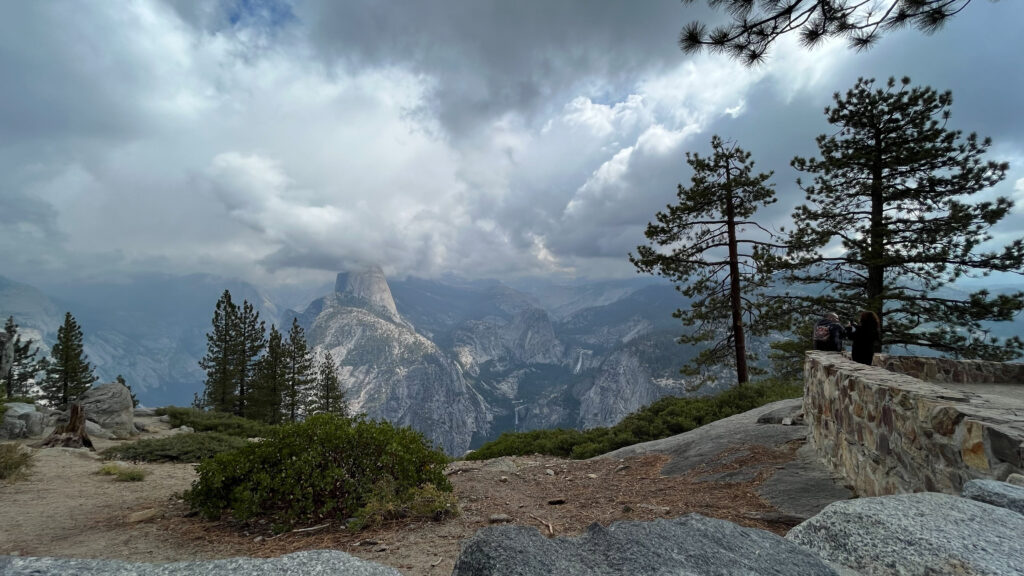
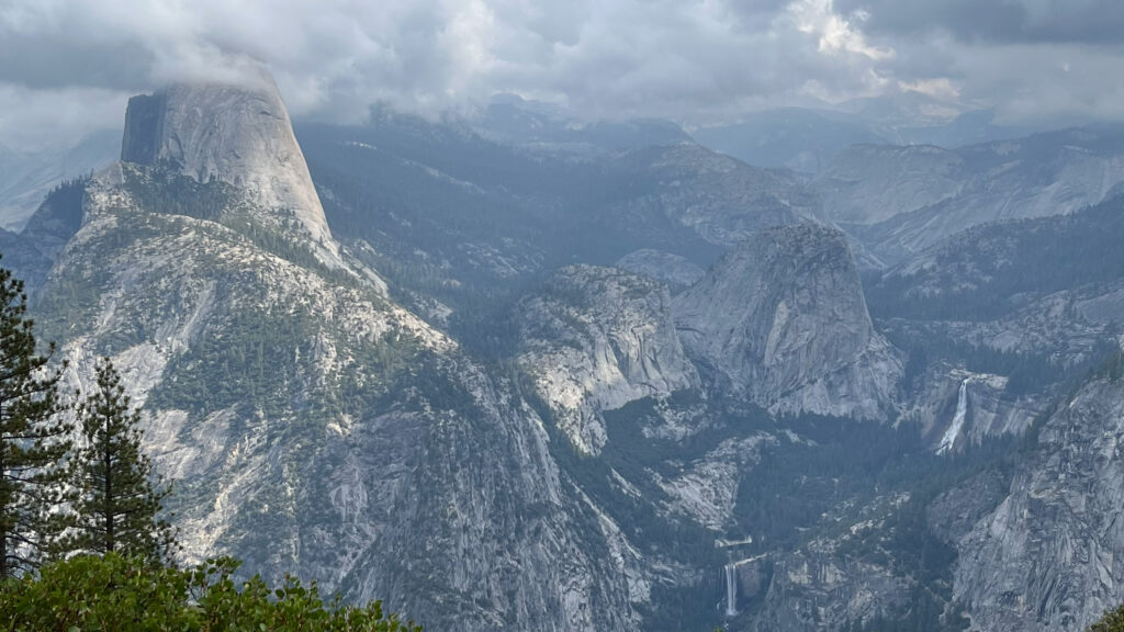
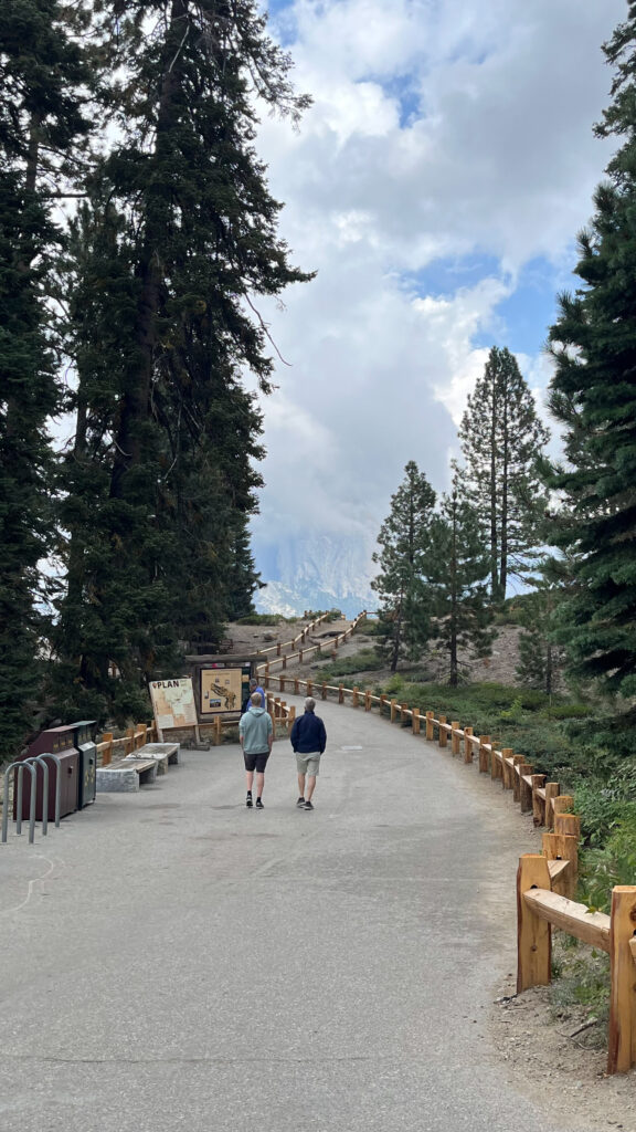
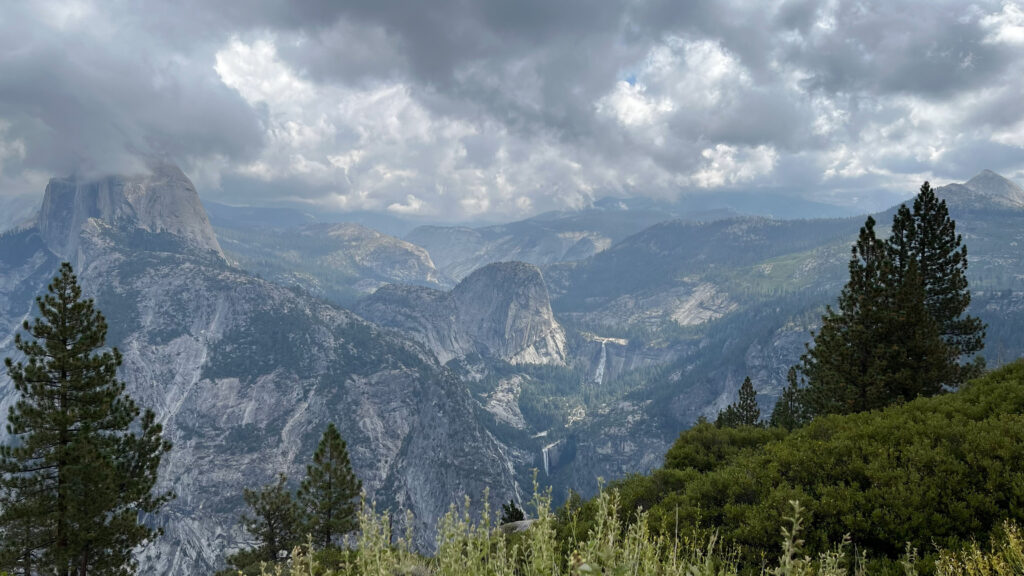
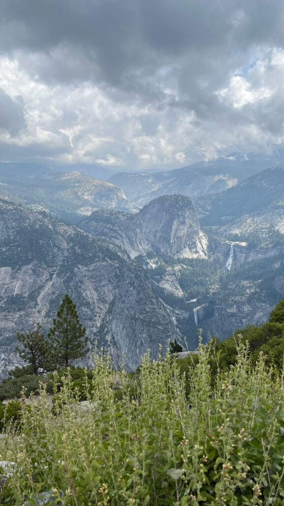
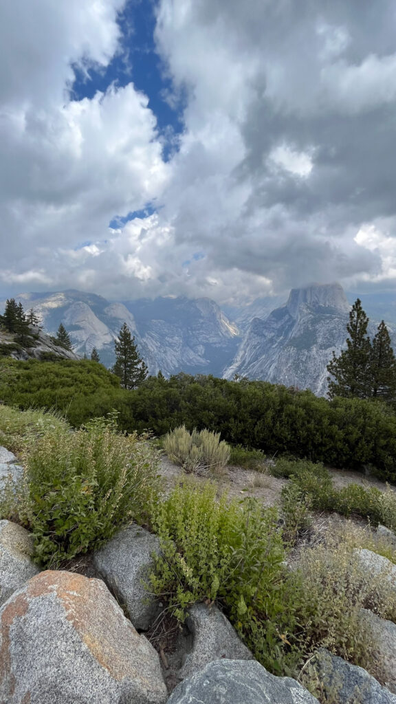
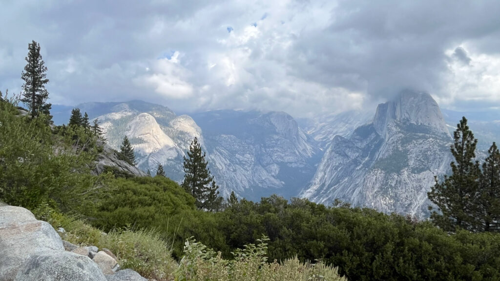
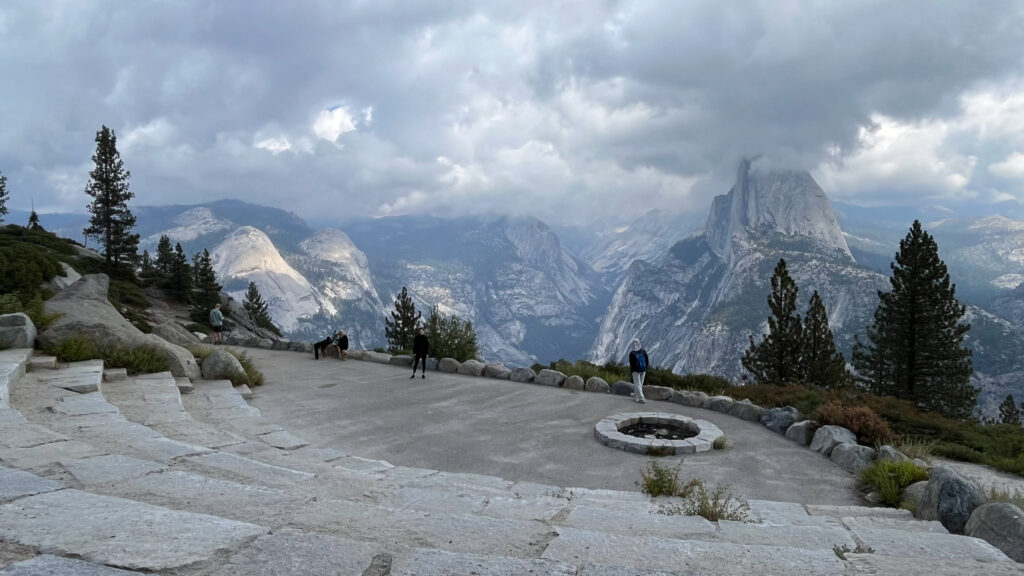
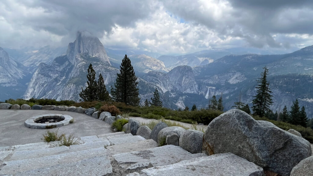
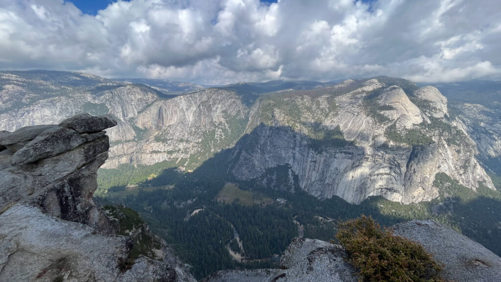
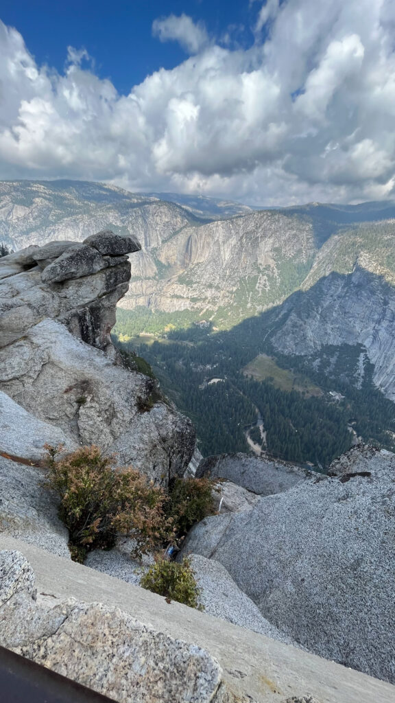
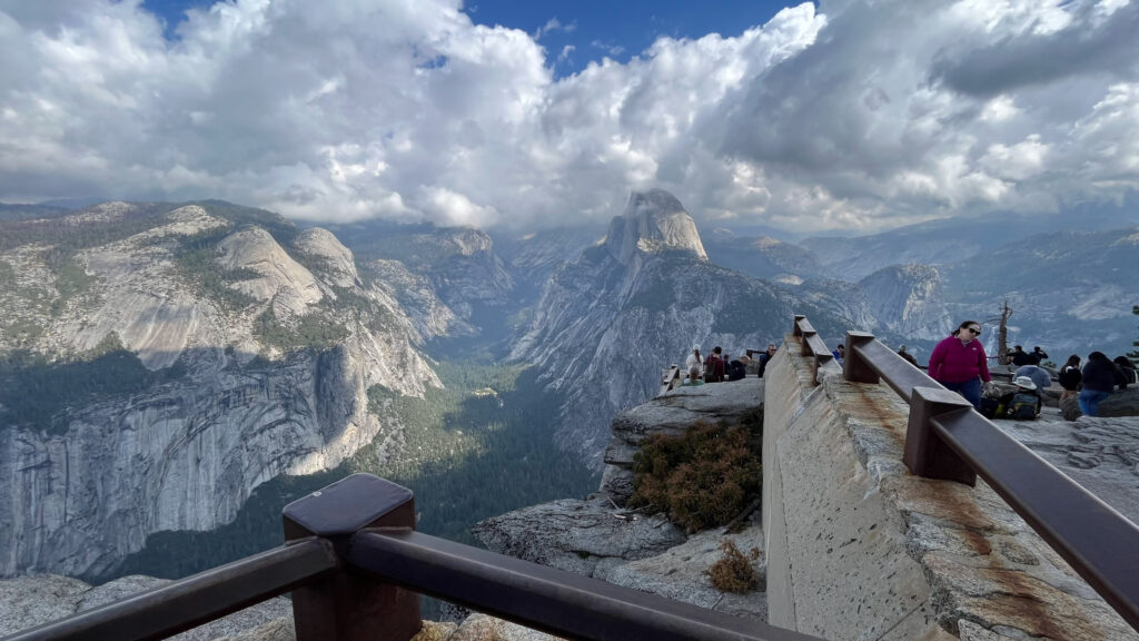
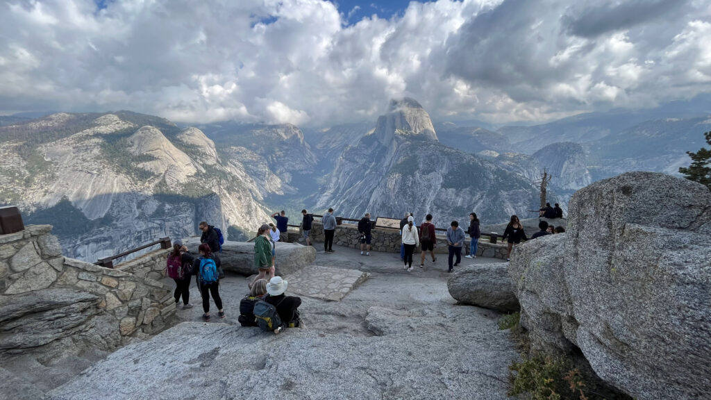
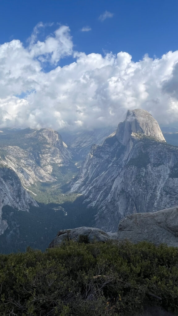
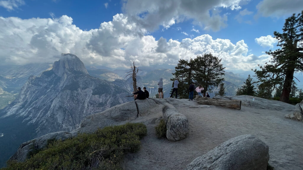
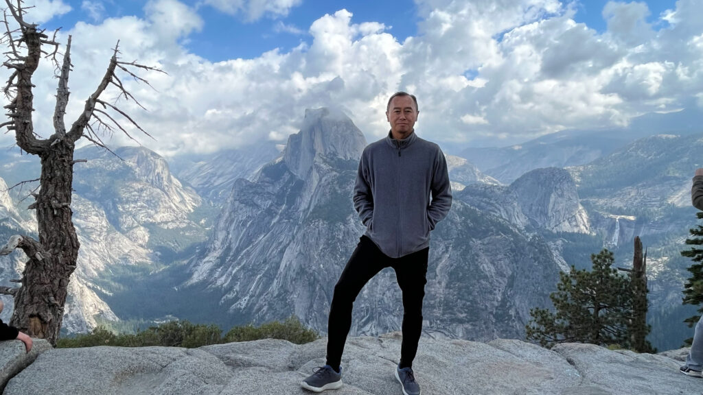
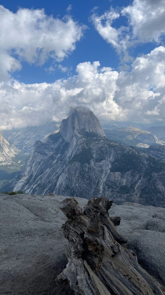
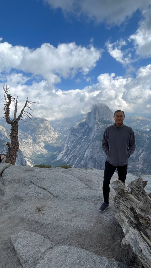
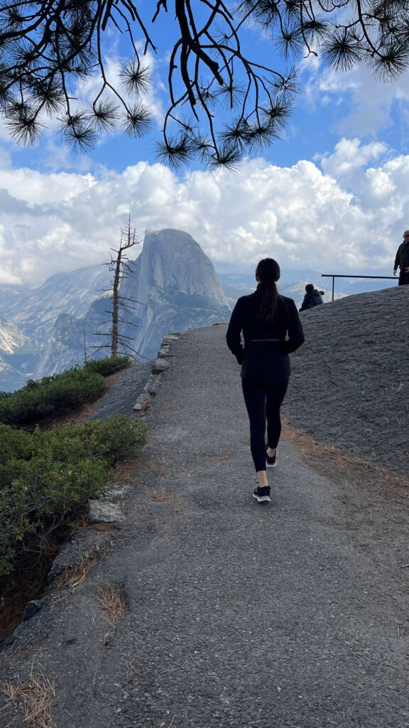
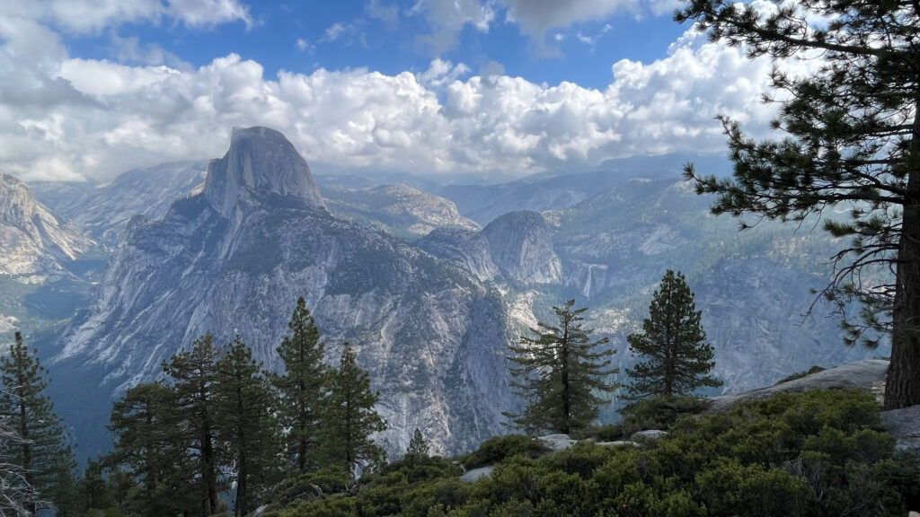
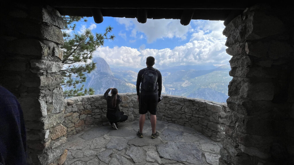
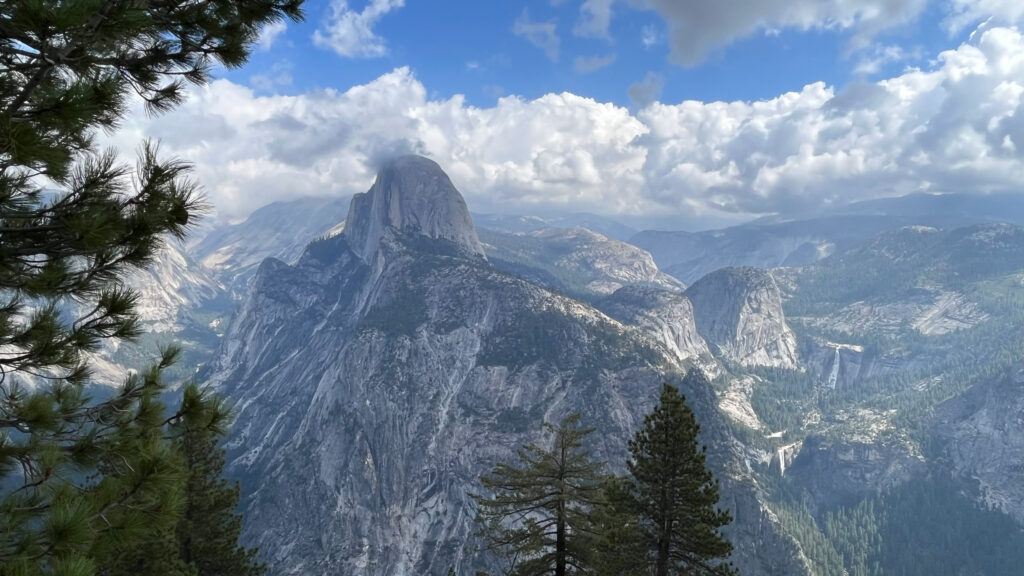
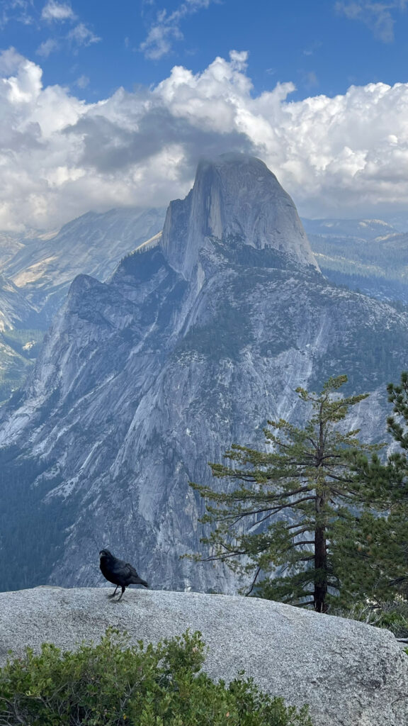
GLACIER POINT
From Washburn Point, we drove about five minutes to get to Glacier Point. Wow! The views from Glacier Point are stunning! There is a paved trail that is wheel chair-accessible from the parking lot to the overlook that took us about three minutes to walk. From Glacier Point you have impressive views of Yosemite Valley, Half Dome, and Yosemite Falls. I’m sharing a lot of photos because Yosemite is so beautiful!
GLACIER POINT GIFT SHOP AND SNACK STAND
A couple minutes walk from where we were at the Glacier Point overlook is this building – Glacier Point Gift Shop and Snack Stand. They have things like pre-made sandwiches and salads and some things you can microwave (they provide microwaves for you to use) and various snack foods and drinks. After seeing what they were selling and that the prices were less than the food we picked up from the deli earlier in the day, we wished we had bought our lunch from this place instead. I don’t know if the food was good, but our sandwich from the deli in Oakhurst was expensive and not very good, so at least we would have saved money. And we like to save money.
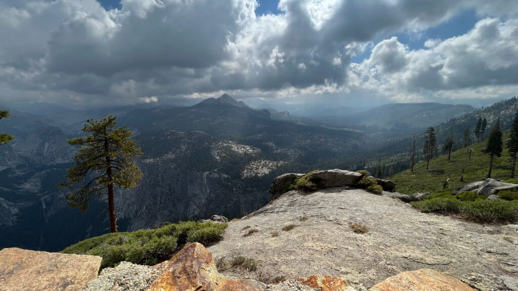
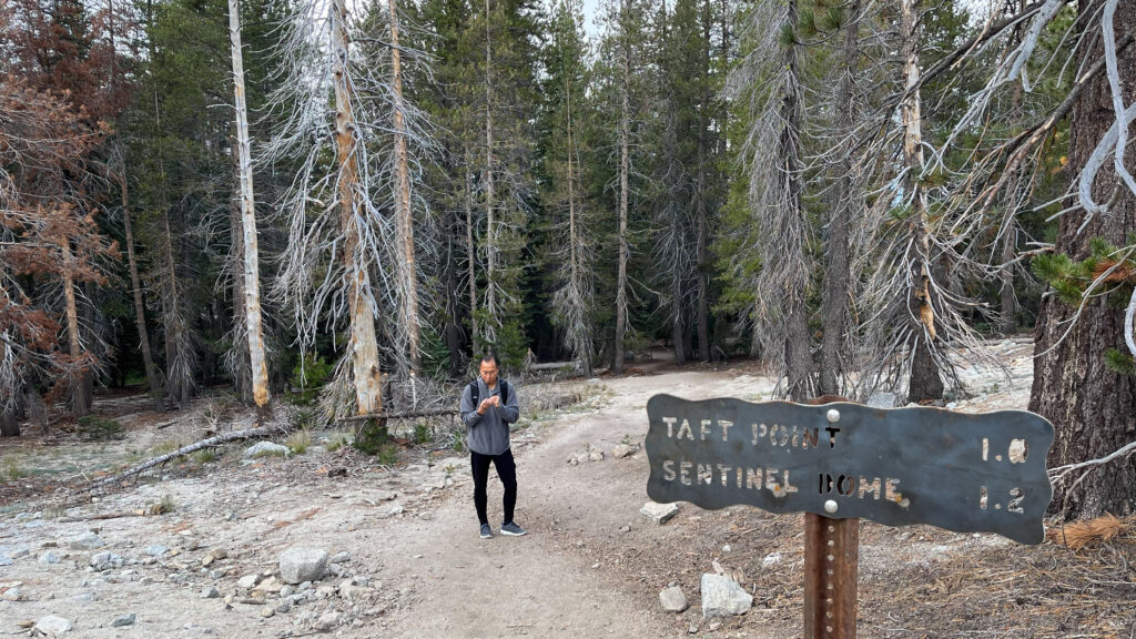
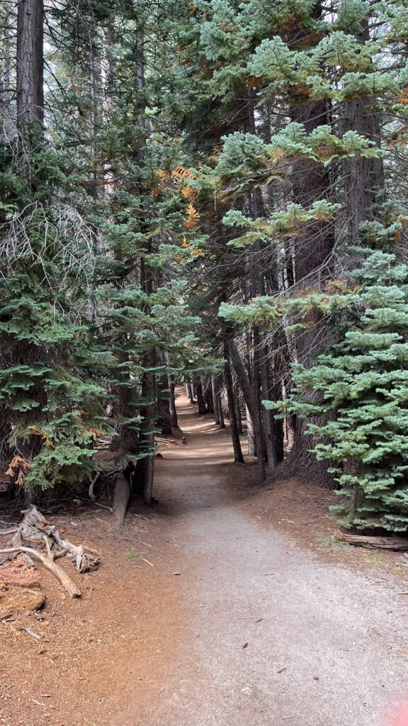
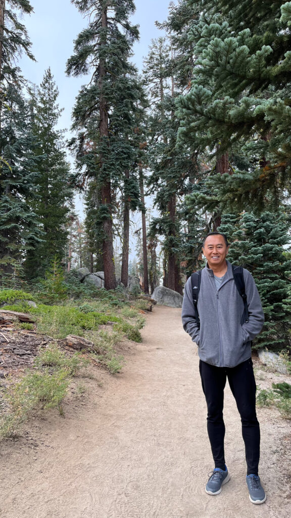
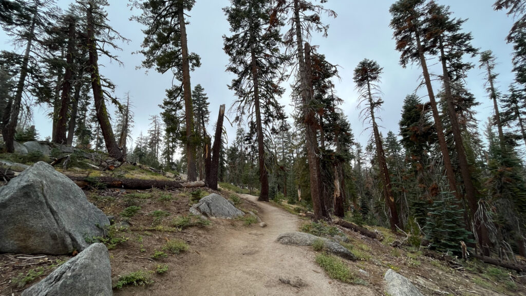
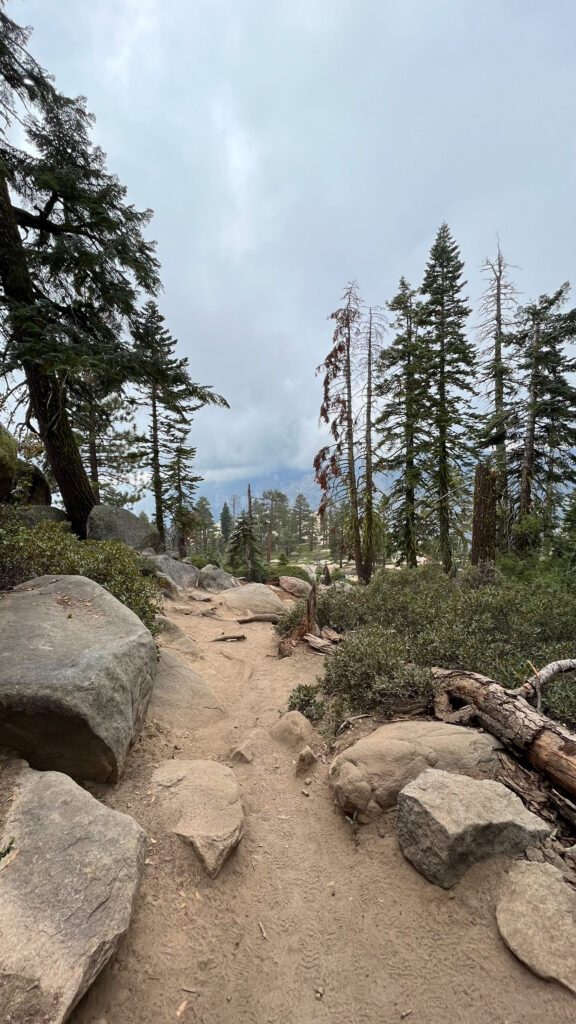
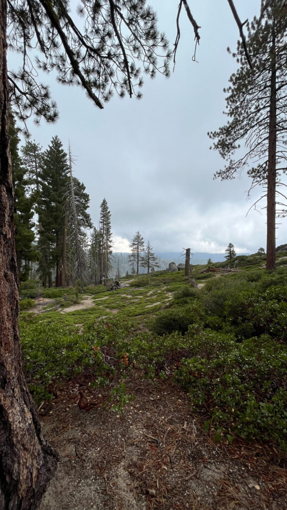
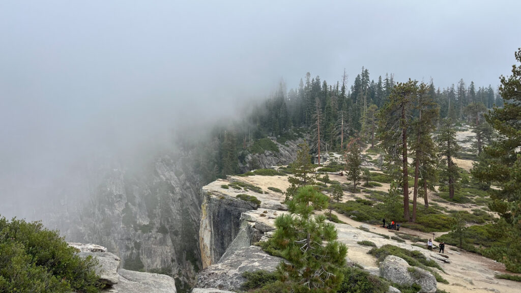
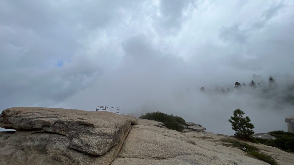
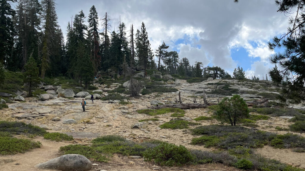
TAFT POINT TRAIL
From Glacier Point we drove about 20 minutes to park next to the Sentinel Dome and Taft Point Trailhead. Both of these trails are considered moderate. (This link provides information on Day Hikes along the Glacier Point Road.)
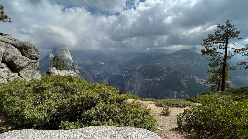
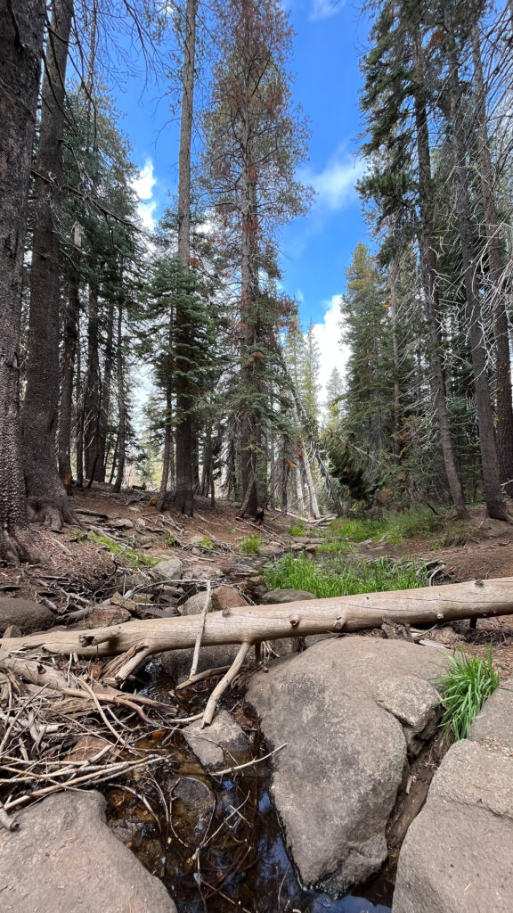
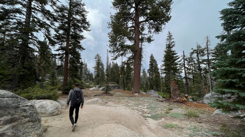
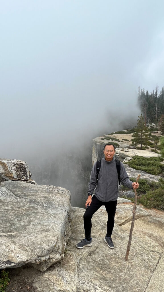
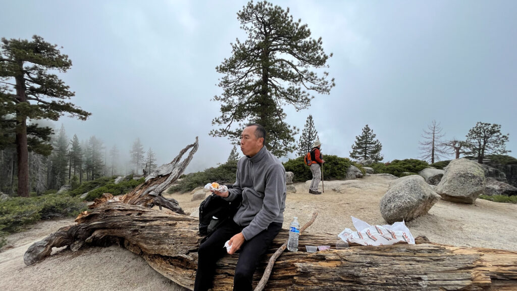
We did the Taft Point trail. In all it took us one hour and fourteen minutes to hike this trail, which included us taking a few minutes to eat our lunch at Taft Point and walking back to the parking lot. We do hike faster than other people, so this hike might take other people more time to do. There were not many other people there the day we were there. It took about 26 minutes to get to Taft Point from the trailhead. We would have spent a little more time at Taft Point, but bad weather arrived when we were up there – more on that later.
The parking lot is not very big, but we did see other parking spaces along Glacier Point Road if needed. There are restrooms shortly before the trailhead, next to the parking lot .
We personally would not have gone to the edge of that cliff for a photo like the person in the photo below did because it’s a risk we won’t take. This link is an example of a couple who fell from Taft Point, and they knew the risk of being on the edge of cliffs, but they still took the risk and paid the price. They were intoxicated at the time of the fall with a tripod set up, so perhaps the intoxication played a role in them falling, but many people have fallen to their deaths from standing on the edge of cliffs. Sure, most people don’t fall, but some do. Corrosion can cause a section of the granite to break off causing you to fall off the cliff, a strong gust of wind can blow you over, a slippery surface from moisture in the air can cause you to slip and fall over the edge, and so on. We prefer to get spectacular views without the risk of falling over the edge, so we were going to go on the ledge where the woman in the photo below was standing, and where many other people have likewise stood, but we were not going to stand that close to the edge like that.
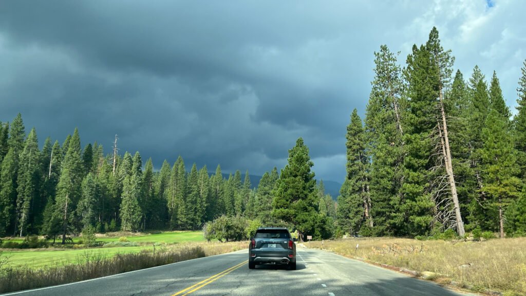
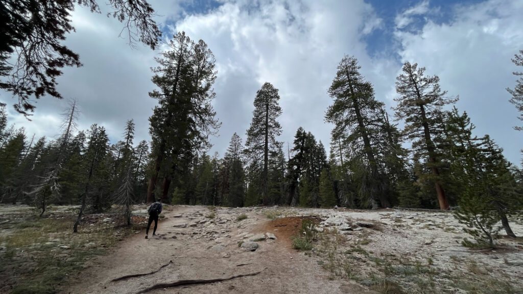
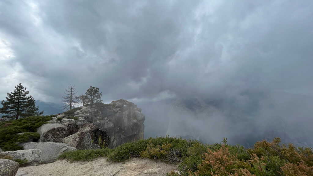
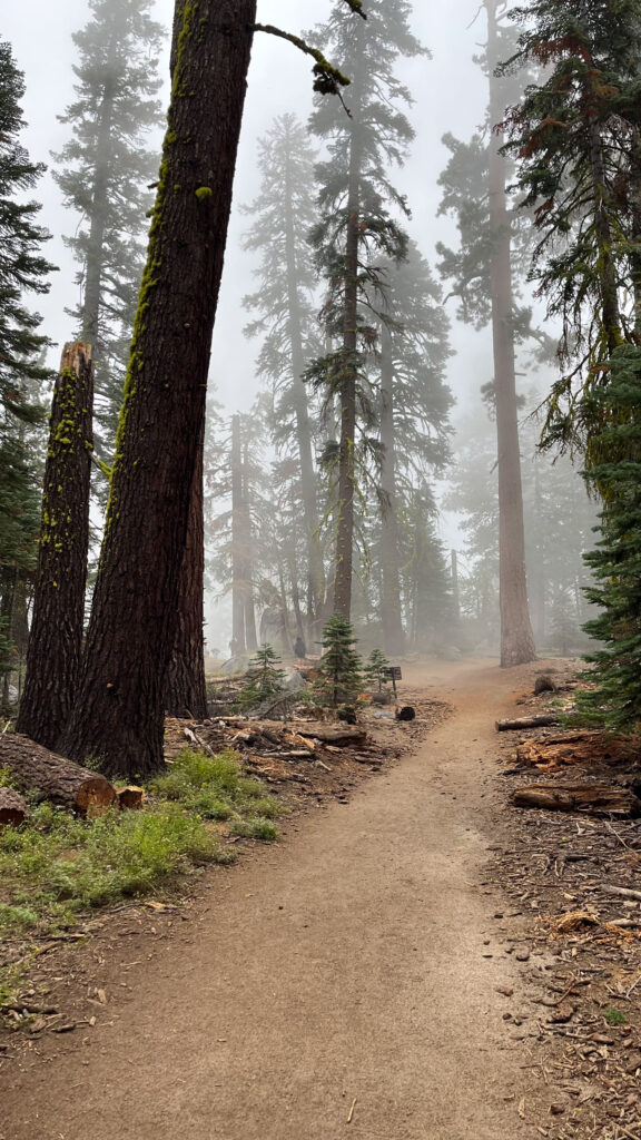
We didn’t end up going up there because shortly before we planned on going up there the rocks started to get very slippery from the cloud mist rolling over the cliffs. Then bad weather rushed in with thunder, lightning and misty rain, so we opted to get away from the heights for safety reasons. Due to the weather, we missed out on some of the great views that Taft Point provides, but we would rather be safe than sorry. Not too much later we enjoyed some spectacular views in Yosemite Valley.
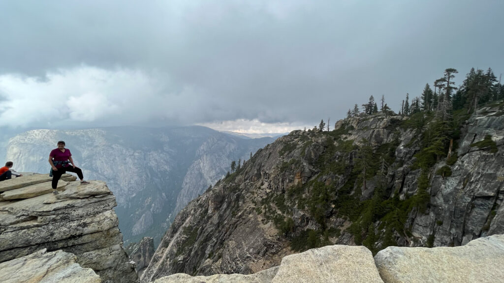
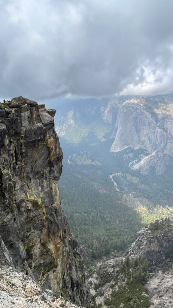
Notice those clouds starting to roll in? Clouds started to rush up from the Valley below. It was dramatic to watch. We took photos and some videos of it because it was really cool looking, and we didn’t think much else of it. Then, a little after finishing our lunch, the thunder and lightning started, so we decided to head back to our car away from one of the high points where lightning is more of a threat. Later on we would find out that the lightning and rain caused injuries over on Half Dome that day. More on that later …
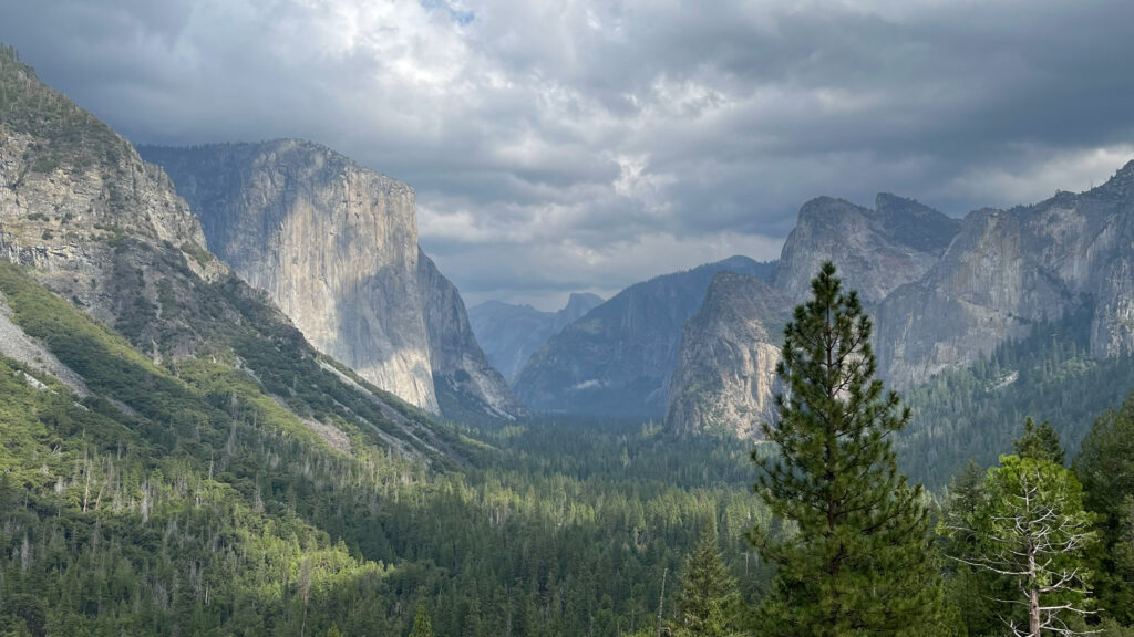
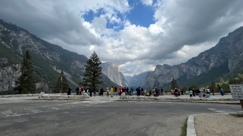
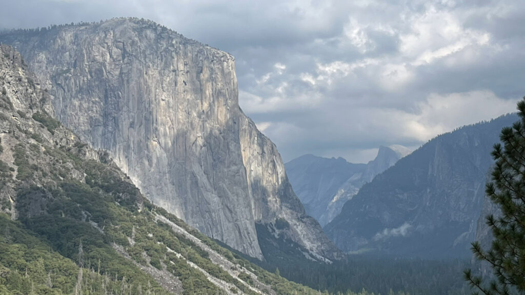
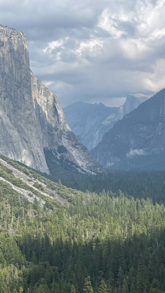
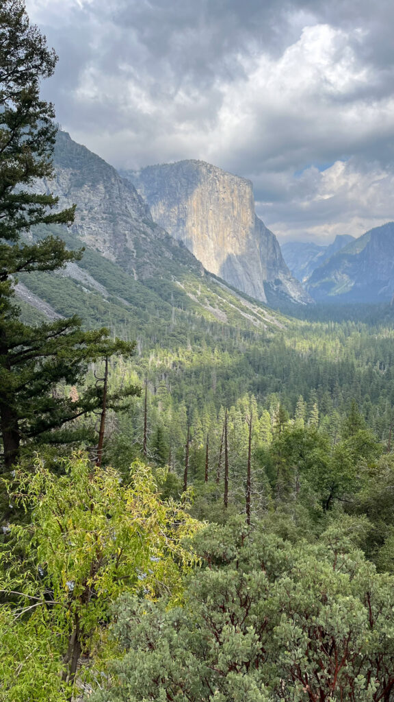
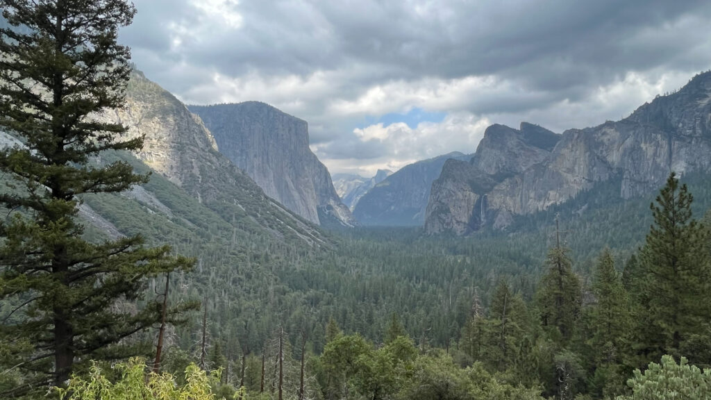
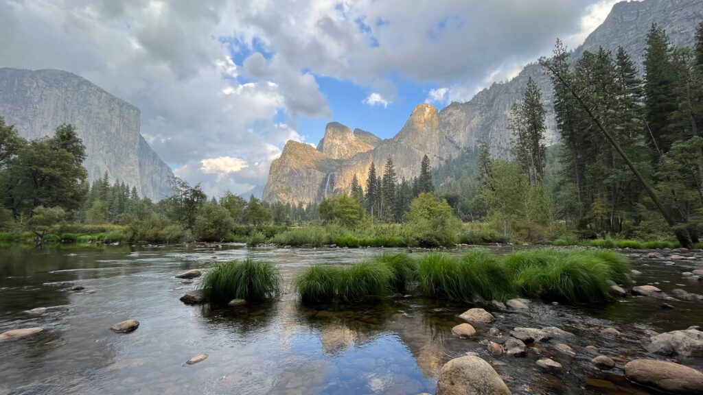
TUNNEL VIEW
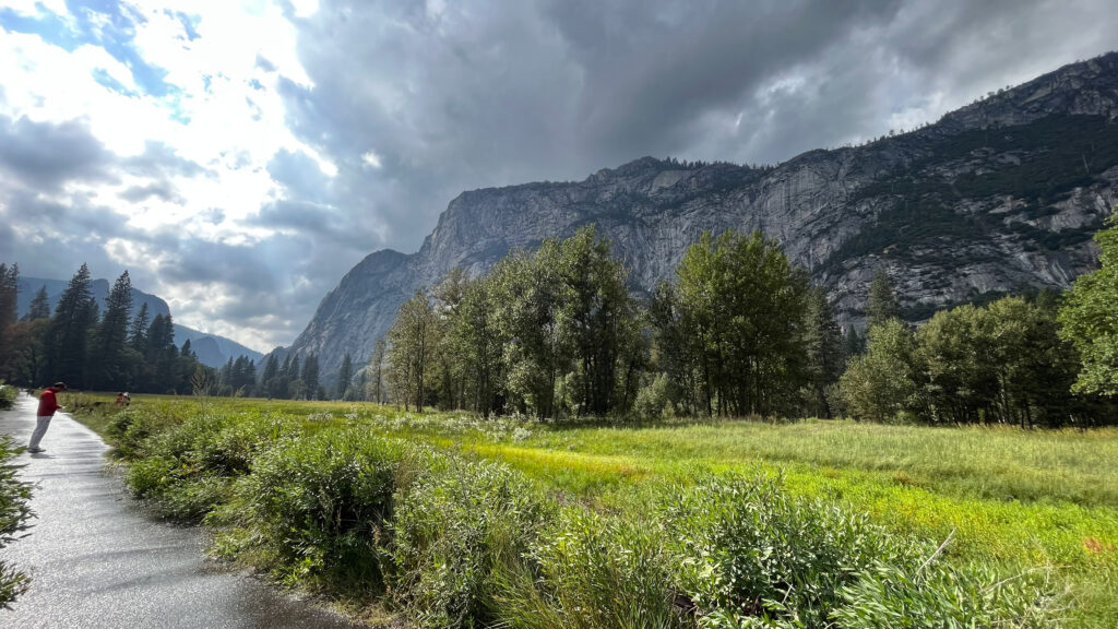
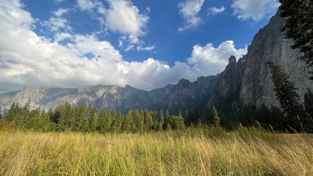
From Sentinel Dome and Taft Point Trailhead we drove about 38 minutes to Tunnel View. At This point we were in Yosemite Valley.
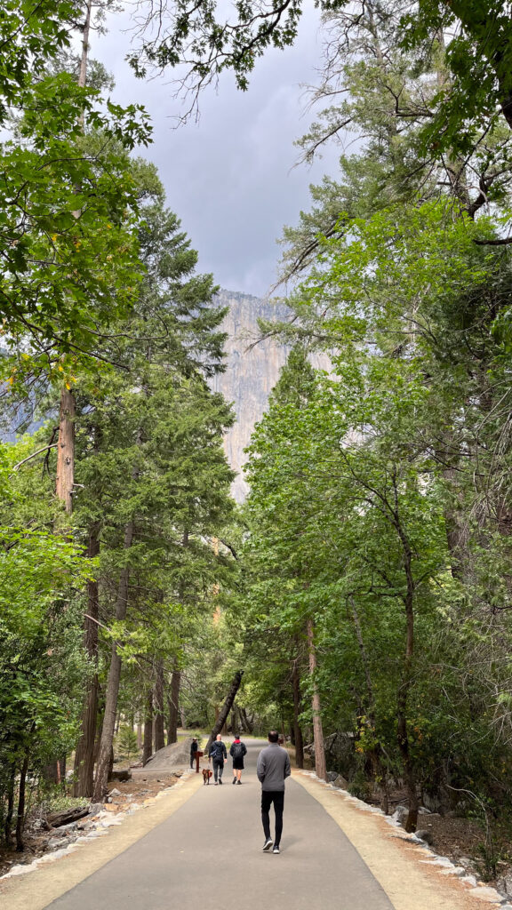
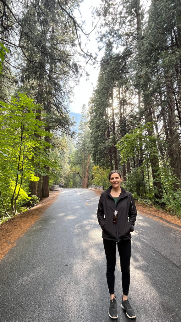
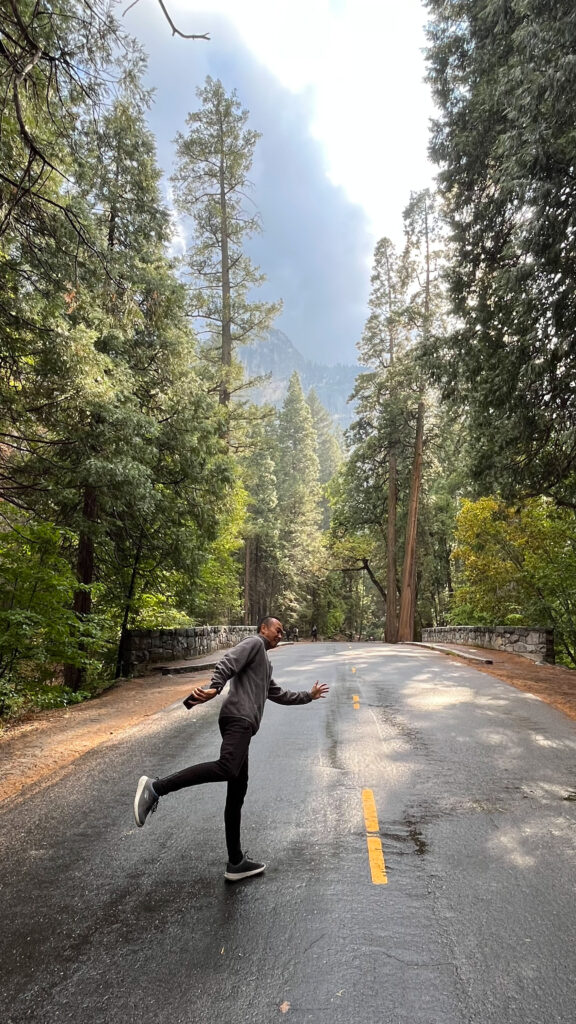
When we were in Yosemite Valley the two lanes were open to traffic moving the same direction, so if we missed something along the way we couldn’t simply turn around to get to it. We started on the south side of Yosemite Valley and headed east, then at the end the road curves around and you head back west on the north side of Yosemite Valley.
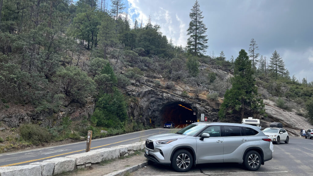
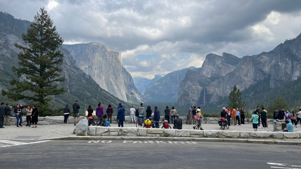
Tunnel View is the first stop on the loop through Yosemite Valley, not long after you drive through a tunnel through a mountain; to get to Tunnel View you make a left into the parking lot shortly after the tunnel.
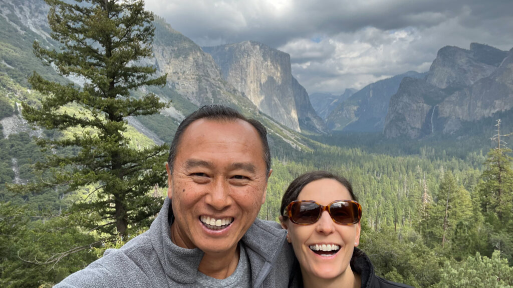
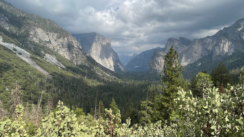
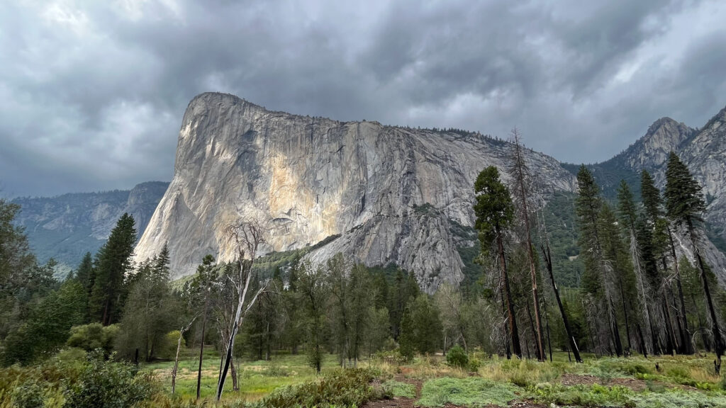
Tunnel View has a large parking lot right next to it that is just off of Wawona Road. There is no hike needed as the overlook is right next to the parking lot, as you can see in the first photo below. And if you go to Yosemite you will not want to miss this view because it is truly magnificent. Ansel Adams appreciated this view and made it famous. This is the iconic Yosemite view. In it you have Half Dome in the far distance, El Capitan on the left and Bridalveil Fall on the right.
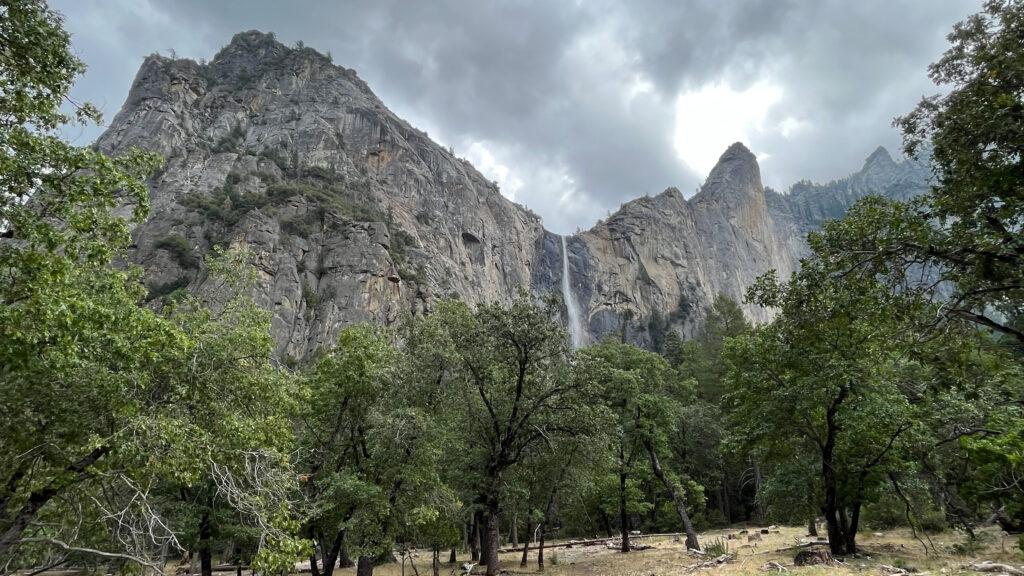
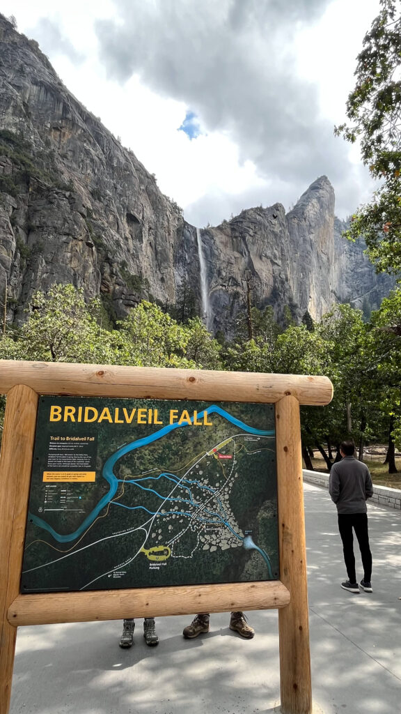
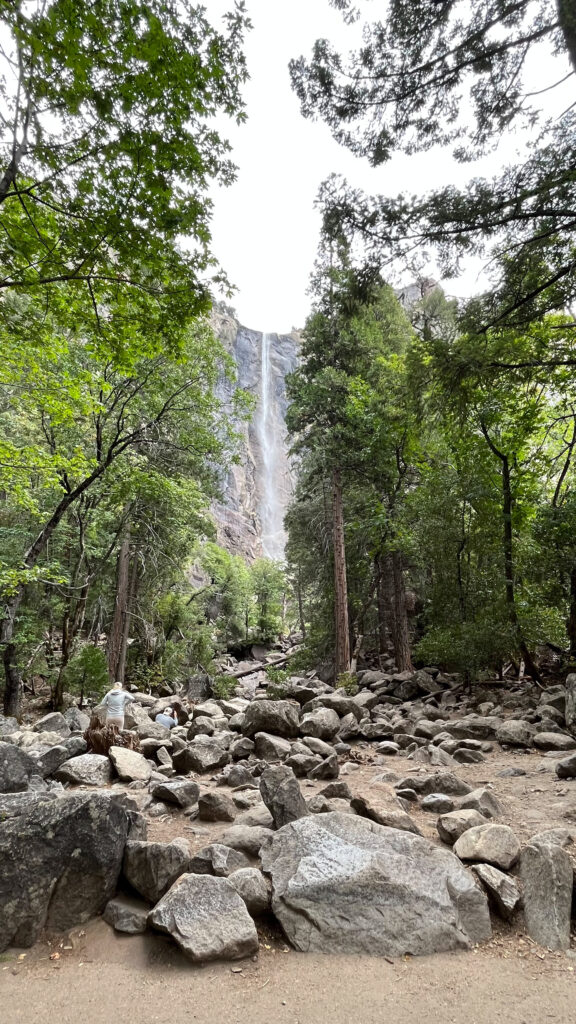
BRIDALVEIL FALL TRAIL
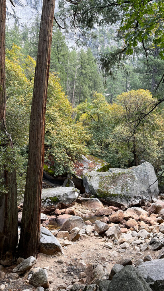
From Tunnel View we drove about five minutes up Wawona Road to park in the parking spots along the side of the road for Bridalveil Fall. We did the Bridalveil Fall Trail to get a closer view of Bridalveil Fall. It took us 14 minutes total from the beginning until the end of the trail. It was an easy walk and very pleasant.

DRIVE FROM BRIDALVEIL FALL TRAIL WITH SCENIC PULLOVERS TO PARKING FOR HIKE TO MIRROR LAKE
From Bridalveil Fall Trail parking we drove a couple of minutes to another parking spot along the road for the following pretty views.
Next we stopped at another scenic pullover on the left side of the road which was about a four minute drive east on Southside Road from the last pullover.
Continuing east on Southside Drive we stopped at another pullover that was on the left side of the road about a four minute drive from the last pullover. From there we walked on a short trail that had a few nice views. It started next to Swinging Bridge Picnic Area.
We tried to find Yosemite Valley Welcome Center and Yosemite Museum, but the road signage was not clear, at least for us it wasn’t, and the way they had both lanes moving in the same direction meant that if we passed a street that we should have turned onto, then we would need to drive around a loop again. The traffic was moving slowly and so we gave up on trying to find those two places. That’s fine though because what’s great about Yosemite is what’s outside, not what’s inside any building.
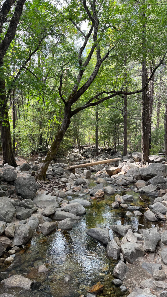
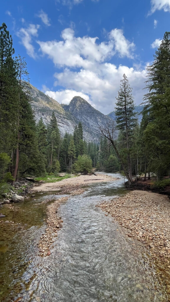
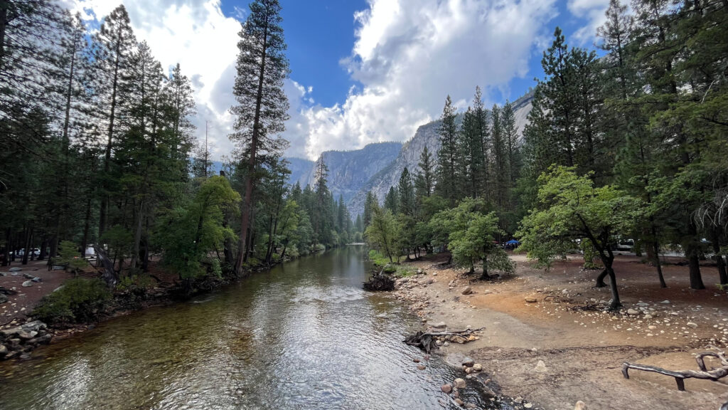
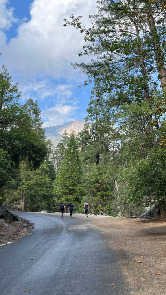
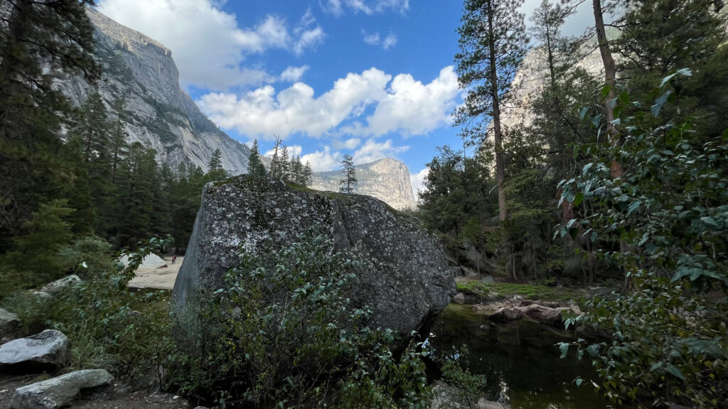
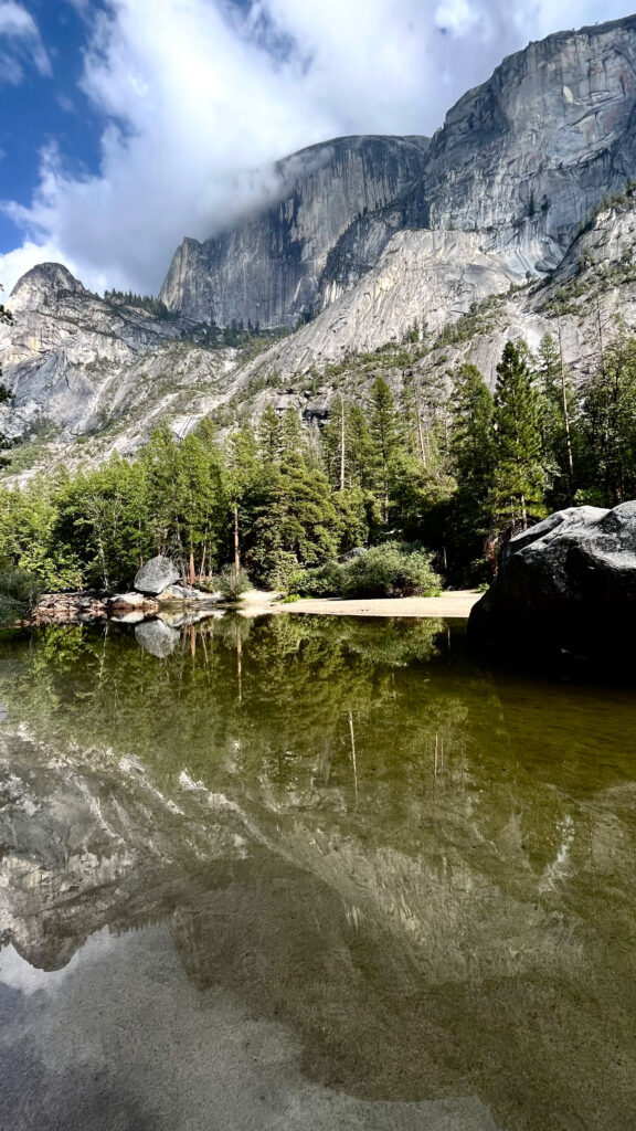
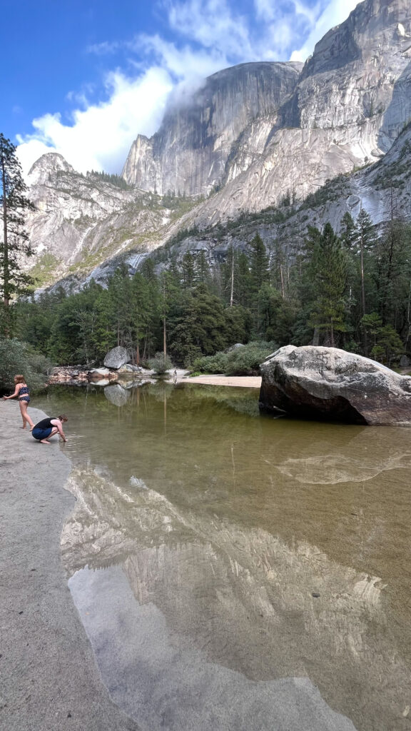
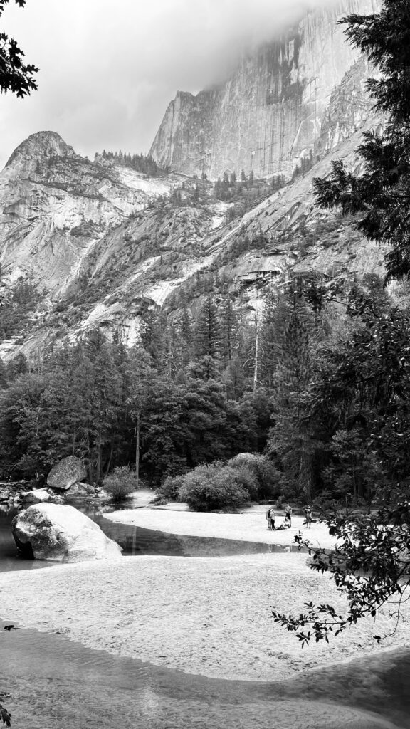
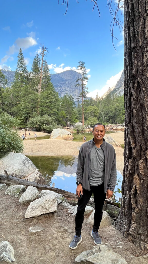
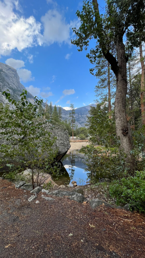
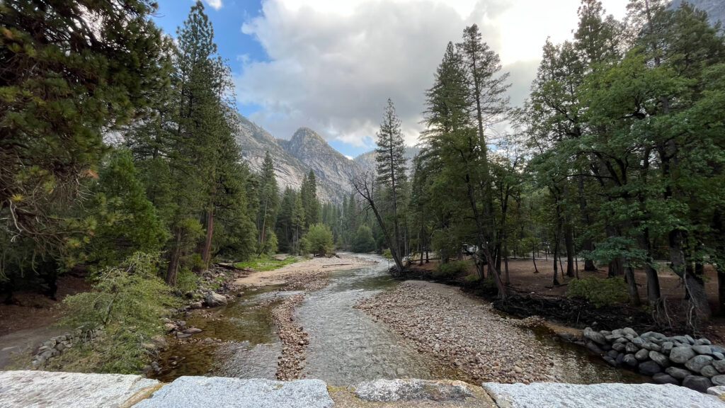
MIRROR LAKE TRAIL
Our next fun thing to do was to hike Mirror Lake Trail. We parked in a parking lot off of Happy Isles Loop Rd that’s on the opposite side of Happy Isles Loop Rd from Upper Pines Campground. According to this link, “Parking is not available at the trailhead. The nearest parking area is at Curry Village, though you can easily access the trail by parking anywhere in eastern Yosemite Valley and taking the free shuttle (get off at shuttle stop #17).”
From the parking lot we walked north/northeast through Upper Pines Campground until we got to the bridge that crosses the Merced River. If you aren’t sure where to go, just ask – someone will direct you to where the trailhead is. It’s about an eight minute walk from the parking lot to the bridge.
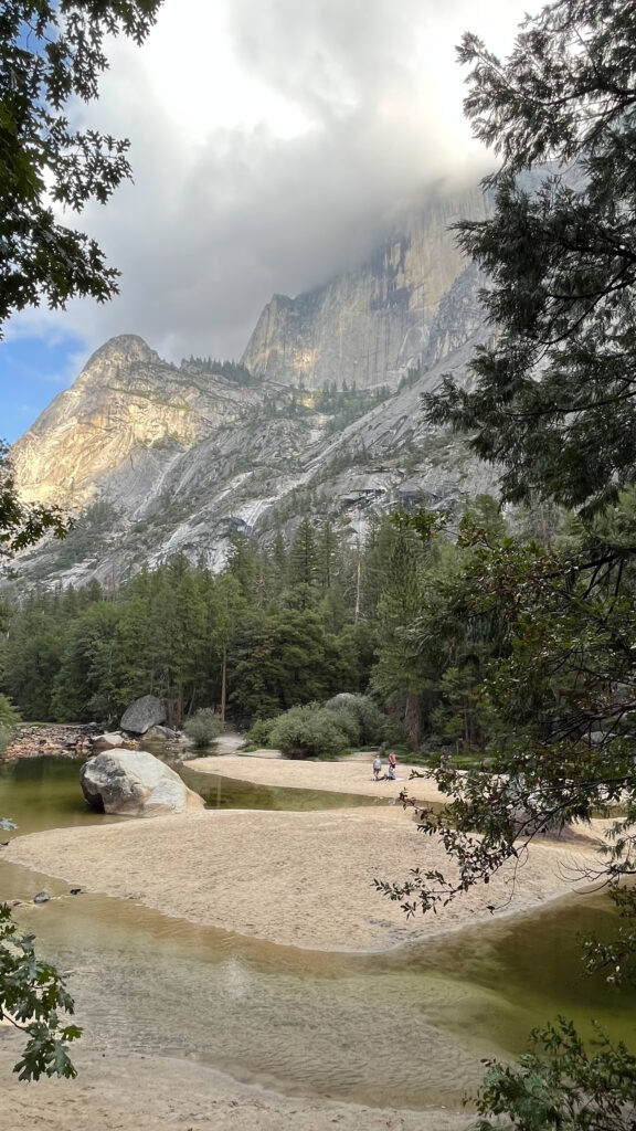
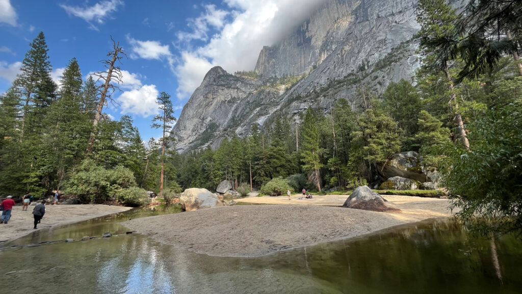
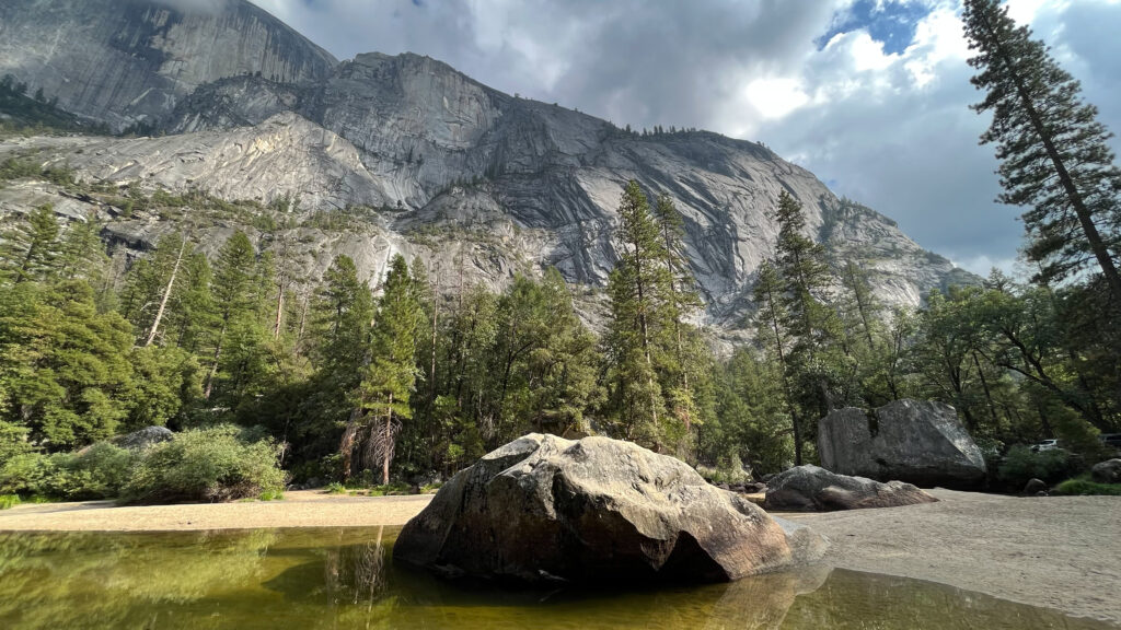
It took us about twenty minutes to walk from the bridge to Mirror Lake. The part of the trail that leads to Mirror lake is a paved service road and it’s easy to walk. We only did the part of the trail that leads to Mirror Lake and then returned to our car. It was a pleasant walk, and we really enjoyed spending time at Mirror Lake. Fortunately for us there was still some water there reflecting Half Dome and Mount Watkins.
While we were at Mirror Lake we heard a helicopter. It hovered for quite some time next to Half Dome, then after a few minutes, it flew way. Then shortly after that we heard the sound of a helicopter hovering again. After hovering for a few minutes it flew away. I had read a news story online a couple of days later that said that two women in separate incidents had slid off of Half Dome that day and they each had to be air lifted from the locations they landed. I tried to find that news story, but the ones I have since found tell of one woman who slid off of Half Dome and was airlifted. So I don’t know if it was one or two women who needed to be airlifted, but it did sound and look like there were two separate helicopter airlifts that happened while we were at Mirror Lake.
This link tells how a few people took shelter in a cave on their way back down Half Dome as the storm started earlier that day. While they were in the cave, a couple of them were hit by lightning. Then on their way back down Half Dome a woman slid down Half Dome and landed on a ledge.
I’m telling what happened the day we were there because climbing Half Dome is very risky. More than twenty people have died on Half Dome, and many more have sustained various degrees of injuries while climbing Half Dome. It is extremely difficult to climb. Sadly many people overestimate themselves and underestimate Half Dome, which leads to many injuries, including serious ones, and, sadly, has lead to deaths.
Back to the rest of our Mirror Lake trail hike. In all we spent about one hour and fifteen minutes from the time we left our car until the time we returned to our car, which included spending about fifteen minutes at Mirror Lake. We enjoyed the entire hike, and especially the time spent at Mirror Lake.
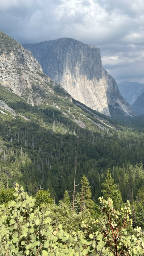
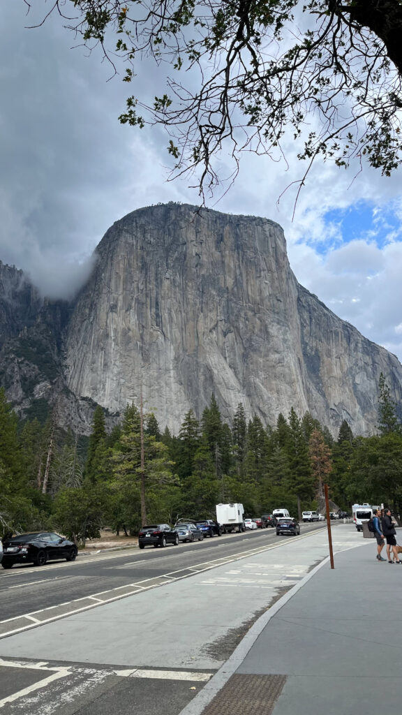
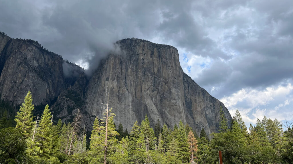
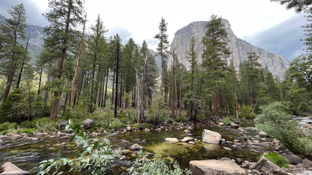
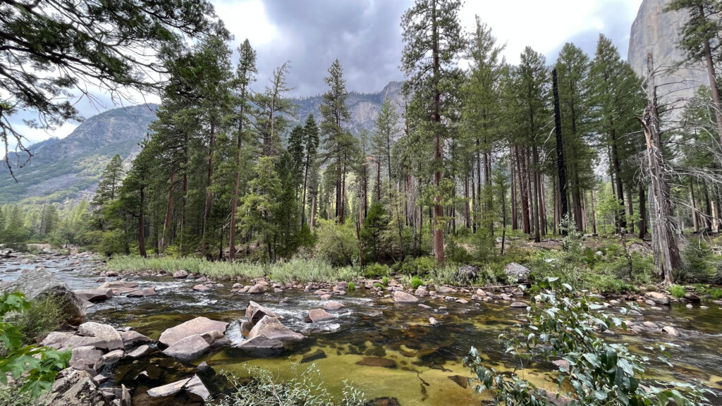
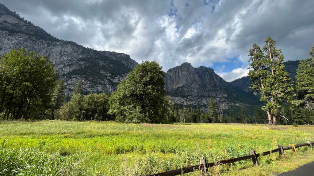
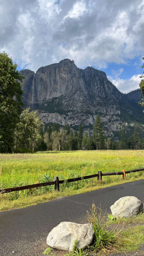
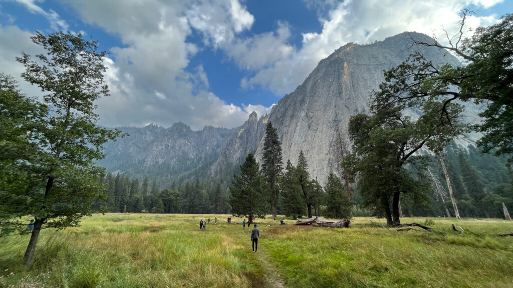
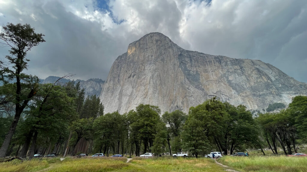
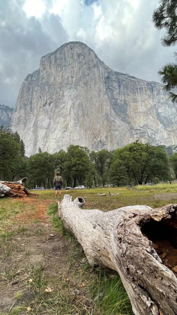
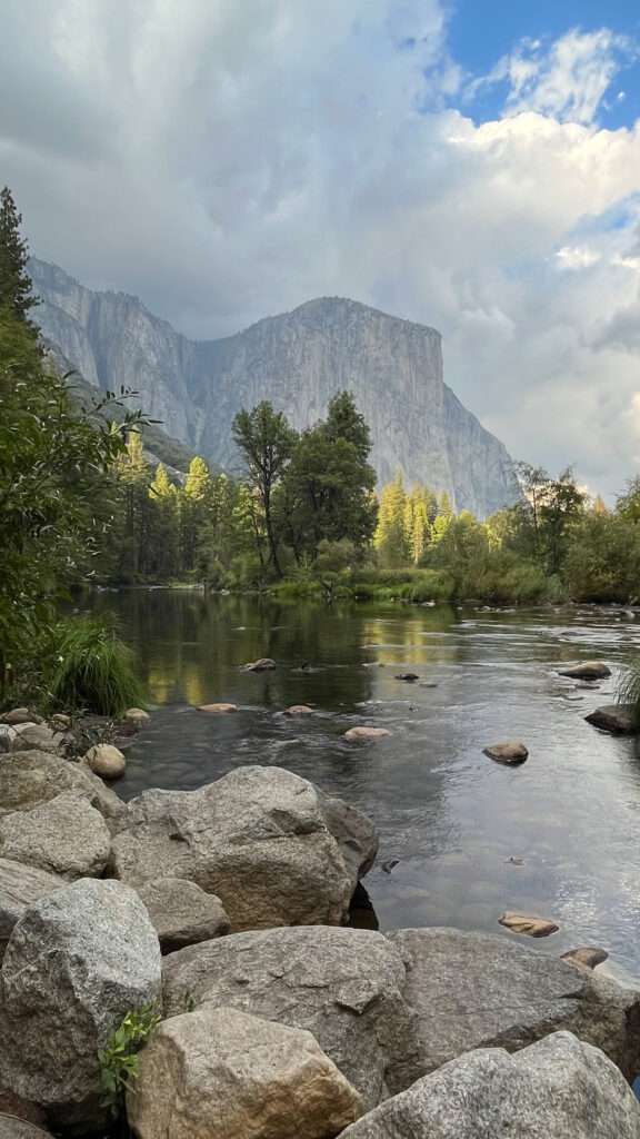
EL CAPITAN MEADOW
After hiking to Mirror Lake and back, we drove west on the north side of Yosemite Valley on to Northside Drive. We stopped at El Capitan Meadow, which, needless to say, provides excellent views of El Capitan. This is a very easy stop; we spent about five minutes total here and got some really nice views of El Capitan as well as Lower and Middle Cathedral Rock and the Cathedral Spires.
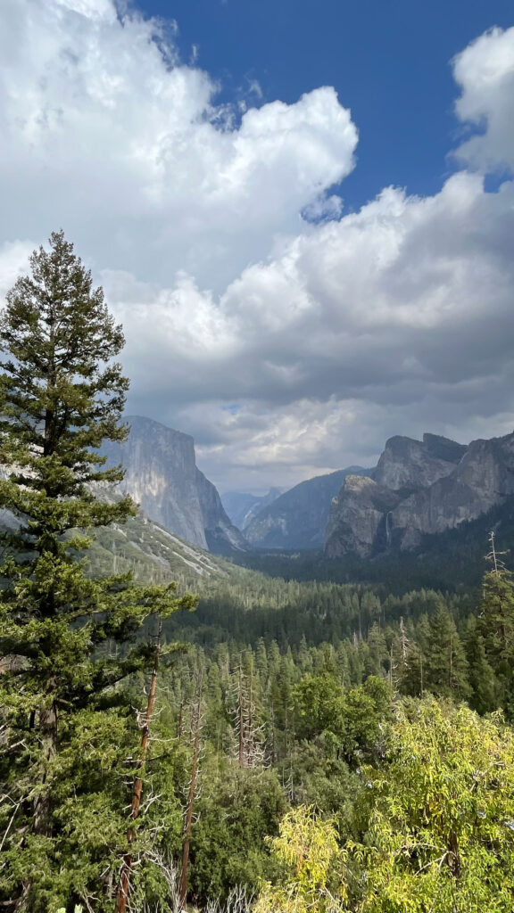
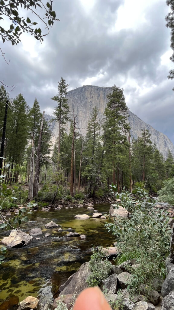
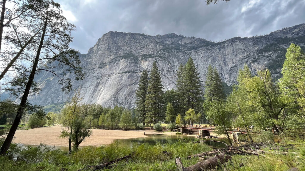
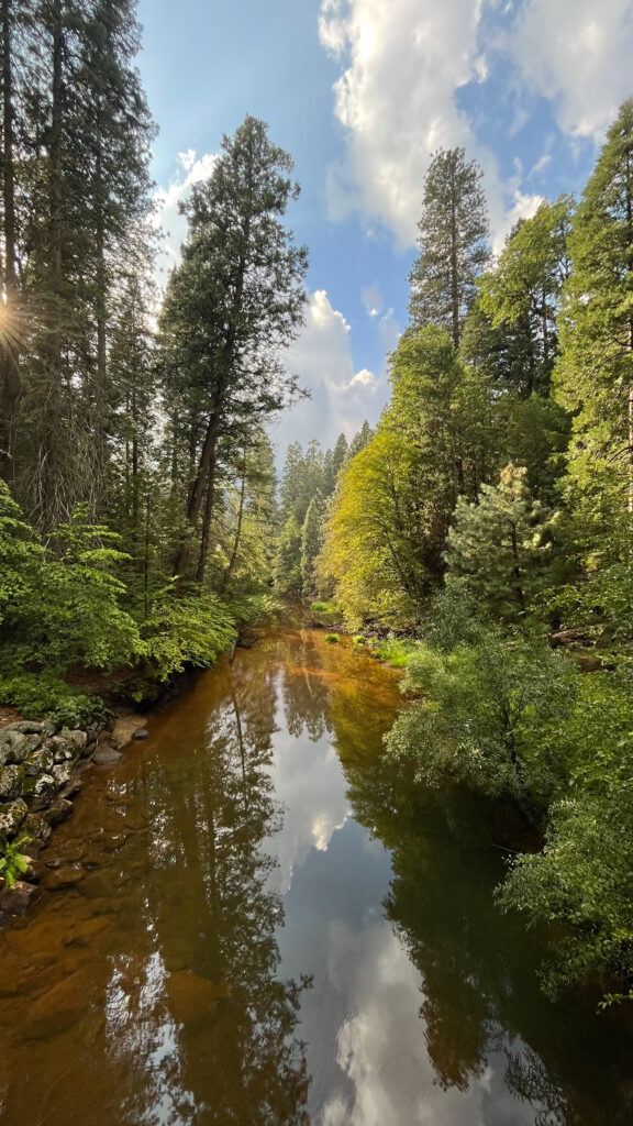
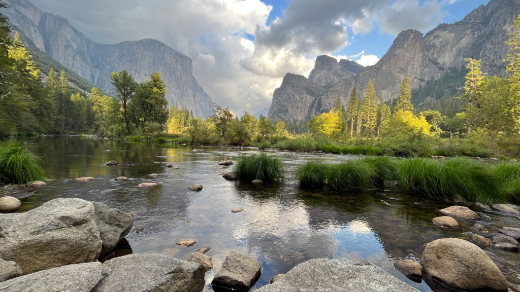
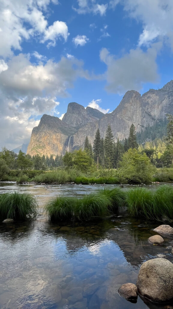
VALLEY VIEW
From El Capitan Meadow we continued driving west on Northside Drive and made a left into the parking lot for Valley View. This was about a seven minute drive from El Capitan Meadow. I was looking out for Valley View and we almost missed it because we did not see any signage for it until we were right there.
We both were in awe of how beautiful this spot is. If you go to Yosemite, do not miss Valley View. Wow! Hardly anyone else was there. The few people who were there were sitting in their cars or in folding lawn chairs a little bit away from the water; I’m pretty sure they were waiting for a spectacular sunset experience from Valley View.
DRIVE TO SONORA, CA
From Valley View we headed to our hotel in Sonora, which was nearly two hours away. The road from Yosemite to Sonora was very windy for quite some time as we drove down the mountain(s), so for people who get motion sickness, please be prepared.
Tap to jump to a specific day:
Leave a Reply